Mykonos, Greece

“All nations whom thou hast made shall come and worship before thee, O Lord; and shall glorify thy name.” Psalm 86:9

Emerald Princess docked in Mykonos

We were greeted with beautiful azure seas and whitewashed homes along the shore as we approached Mykonos. The temperature was rising quickly, and it is expected to be in the low 80s.

Windmills of Mykonos

One of Mykonos’ most famous landmarks are its windmills. These windmills are approximately 700 Years old. They were used to grind various kinds of grain for flour.

Our lunch was at a little place called the “Taverna Vergos.” We were served bread, salad with olive oil and vinegar, cheese pie (a pastry stuffed with a soft cheese) with two dips similar to hummus, rice , and a hamburger patty. Dessert was Greek yogurt with honey, strawberries, watermelon, and banana. Finally, we had a traditional Greek meal! It was delicious!

Delos

We boarded a boat for the island of Delos. In Greek mythology, this is the birthplace of Zeus’ twins, Apollo and Artemis. The entire island is a nationally protected site. The island is about 2.5 miles long and 1 mile wide.

Top: overlooking some of the Delos ruins

Clockwise from top-left: marketplace; house with fresco; lions of Apollo’s sanctuary; sacrificial bulls decorated with flowers

Panagia Tourliani Monastery

This is a Greek Orthodox Church. Inside a Greek Orthodox church, there is always an icon of the “Virgin Mary with her child” to left of “royal door.” The royal door is where the priest enters the church. To the right of the door, the icon is always Christ. The Virgin Mary icon is always given gifts to show adoration, and the most important thing a worshipper can do is kiss her icon.

Top: Virgin Mary icon, royal door, Christ icon. Bottom-left: Virgin Mary icon close-up. Bottom-right: Archbishop’s throne.

Kalafati Beach

Our last stop of the day was at Kalafati beach. We sat in an outdoor refreshment area, where John treated me to a Coke Zero and a strawberry gelato!

Next stop: Athens, Greece

Chania, Crete

“Wherefore he is able also to save them to the uttermost that come unto God by him, seeing he ever liveth to make intercession for them.” Hebrews 7:25

In 1898, the island of Crete was liberated from the control of the Ottoman Empire. In 1913, Crete was united with the mainland of Greece.

Chania

Chania is a big city on Crete, and was the site of a Minoan settlement that used to be called Kydonia. If you are familiar with Greek mythology, it is here where King Minos had his beautiful castle that housed the ferocious Minotaur in an underground labyrinth.

The Minoan civilization flourished during the Bronze Age (2000-1500 BC). Throughout its history, there were several different groups that ruled this area, including the Romans, Arabs, Byzantines, Venetians, and Turks. Chania was built around Kastelli Hill, a natural landform rising above the harbor. Around the harbor, you can see the old Venetian wall and fort.

Greek Orthodox Church

In 320 AD, this was a Dominican (Catholic) monastery. When the Ottomans were here, they converted it to a mosque. When Ottomans left (1918), the people kept the minaret and the clock tower because there were still Cretan Muslems here. After the end of the war, Muslems had to leave Crete, and Christians had to leave Turkey. This church is now a Greek Orthodox Church dedicated to St. Nikolas. This church has been the worship center for three different religions!

Tomb of Elefthérios Venizélos

Elefthérios Venizélos was a famous politician (justice minister) in Crete as was his son. He worked on the union of Crete with the mainland. In 1910, there was a revolution demanding the unification of Crete and Greece, which he led. The site of their tombs overlooks Chania Bay.

White Mountains (Lefka Ori)

It’s highest peak is Mt. Ida (8,000+ ft), and these mountains often have snow until June. There are five mountain ranges in Crete, and they are very popular with hikers.

Greek Orthodox Cathedral of Chania

The cathedral was built in the 19th century and is known as the Three Martyrs Church (Trimartyre). Inside there are three aisles. One is for Mary; one is for St. Nicholas, and one is for the Three Holy Hierarchs.

Mosque of Hassan Pasha

This is the first mosque built in Crete after the Byzantine conquest (1649).

Lighthouse and Forteza

Both were constructed by the Venetians in the 16th century.

British War Cemetery

Resting place of 1,527 Allied soldiers and Cretan resistance fighters who died in the battle for Crete in 1941 during the last ten days of May. Many were evacuated, but those who were not, stayed and fought.

Byzantine Wall

This wall was built over the remains of an earlier fortification of the Hellenistic period (larger blocks at bottom). The Venetians built on top of this, which is evidenced by the round sections. The top layer of this wall is from the Byzantine era. It is part of the wall that surrounded ancient Kydonia (Chania).

Next stop: Mykonos, Greece

Corfu, Greece

“For I am not ashamed of the gospel of Christ: for it is the power of God unto salvation to every one that believeth; to the Jew first, and also to the Greek.” Romans 1:26

Corfu is the second largest island in the Ionian Sea (634 square km), and is located at the entrance of the Ionian Sea.

With a population of approximately 110,000 people, Corfu is a popular vacation spot and has had celebrities and royalty (both past and present) here on a regular basis. Once a kingdom, it is now a presidential republic. In addition to being conquered by the Venetians, Corfu was part of the British empire between 1814-1864. In 1864, Queen Victoria gave Corfu back to Greece in 1864, and her nephew became the king of Greece.

Landscape – Olive trees are everywhere, covering the slopes of mountains and filling in valley floors. Olives are harvested every other year, producing 15,000 tons of olive oil annually. In the 8th century, Corfu exported olive oil, but now none is exported because the amount of oil produced only meets the needs of the local population. There are only 300 olive presses here, but they are no longer used. Instead, the Corfiats use a “cold press” method that does not crush the olives when extracting the oil. There are 4 million olive trees on Corfu, but only 1.8 million actually produce olives. The trees must be pruned to continue to produce olives, so many wild ones have stopped producing fruit. Cyprus trees (long, thin) are also found on the mountainsides. They are a symbol of fertility, and they grow in the wild, protruding out above the olive trees.

There are also citrus trees such as lemon, loquat and kumquat. The loquat has only two seeds and is sweet on its own, while the kumquat does not have seeds and needs to be sweetened. Almond and cherry trees can also be found here.

Paleokastritsa

We began our day by visiting a place called Paleokastritsa Bay. Here was a small town located on the shores of the NW coast of Corfu. This bay has with 6 small coves, and we stopped at one of them

Rugged rocks jutted out of the water, and one was attached to a Greek legend. Homer wrote that this was the place where Odysseus traveled and received a ship from Corfu to travel home to Ithaca. Supposedly, his ship was turned to stone by an angry Poseidon, the Greek god of the sea, and one rock formation in the bay is that ship.

Center-right is Odysseus’ petrified ship.

Greek mythology was once the religion of ancient Greece and widely accepted as truth until the Greek philosopher Socrates questioned the beliefs. Socrates was the first Greek to speak of one god, and he was sentenced to death for that because the concept was simply too radical for the people of those times. However, after 70 AD the Greek Orthodox Christian Church became the main religion when the apostle Paul sent his disciples here to share the gospel of Christ. While Greek Orthodox is the primary religion now, Catholic churches can be also found due to the past influences of the Venetians.

Bella Vista

After visiting the cove, we headed up a very serpentine road to a mountainside stop overlooking Paleokastritsa. We were able to see the place where we first stopped.

Right past this stop was the Monastery of the Virgin Mary, a Greek Orthodox monastery. There are only two nuns residing there now, but they do a lot of charity work and are currently trying to renovate the monastery.

Achillion Palace

Our third stop was the Achillion Palace. It was built in 1890-1892 by Elisabeth, an Austrian empress. She lived here after the death of her son and remained in mourning until she was assassinated in 1898. This palace was dedicated to the Greek hero, Achilles. Two of his statues are located in the garden. One depicts him as the brave warrior, while the other shows him dying with an arrow in his heel.

Clockwise from to-left: front of palace; courtyard; statue of Empress Elisabeth; palace statues; statue of Achilles

In addition to the statues of Achilles, there are statues of Apollo (god of music), the muses, Zeus and Hera, as well as others. There is a beautiful statue of the empress in the entry way, a testament to her beauty, charm, and love for this place. Hollywood trivia: The casino scene in the James Bond film, “For Your Eyes Only,” was filmed in this palace.

The Old Fortress

During the 15th century, the Venetians built a fortress on top of the remains of an old Byzantine castle. It was surrounded by an artificial moat, and it has a moveable drawbridge, which attached the fort to the mainland of the island. It has a clock tower, a lighthouse, and a large cross that is visible from the town of Corfu.

We walked around the esplanade and main square of Corfu before heading back to our ship.

Clockwise from top-left: Old Fortress; train transport; horse and carriage transport; flowers in the square; esplanade walkway built by Napoleon; park statue plays peek-a-boo with…can you see?

Next stop: Chania, Crete

Kotor, Montenegro

“Lift up your eyes on high, and behold who hath created these things…” Isaiah 40:26a

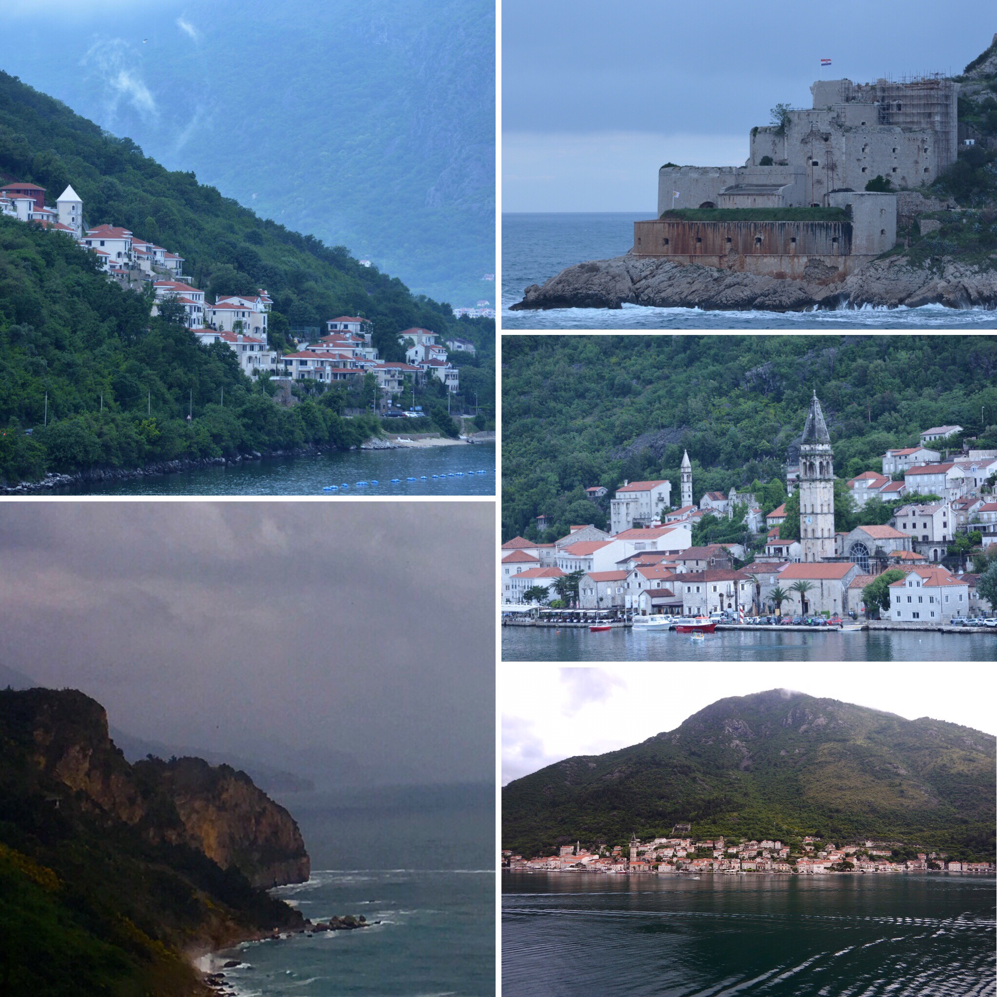
Our day started with pouring rain. We navigated through a beautiful fjord flanked by tall forest covered mountains with lots of houses at their bases, and then dropped anchor in the Bay of Boka at the end of the fjord.

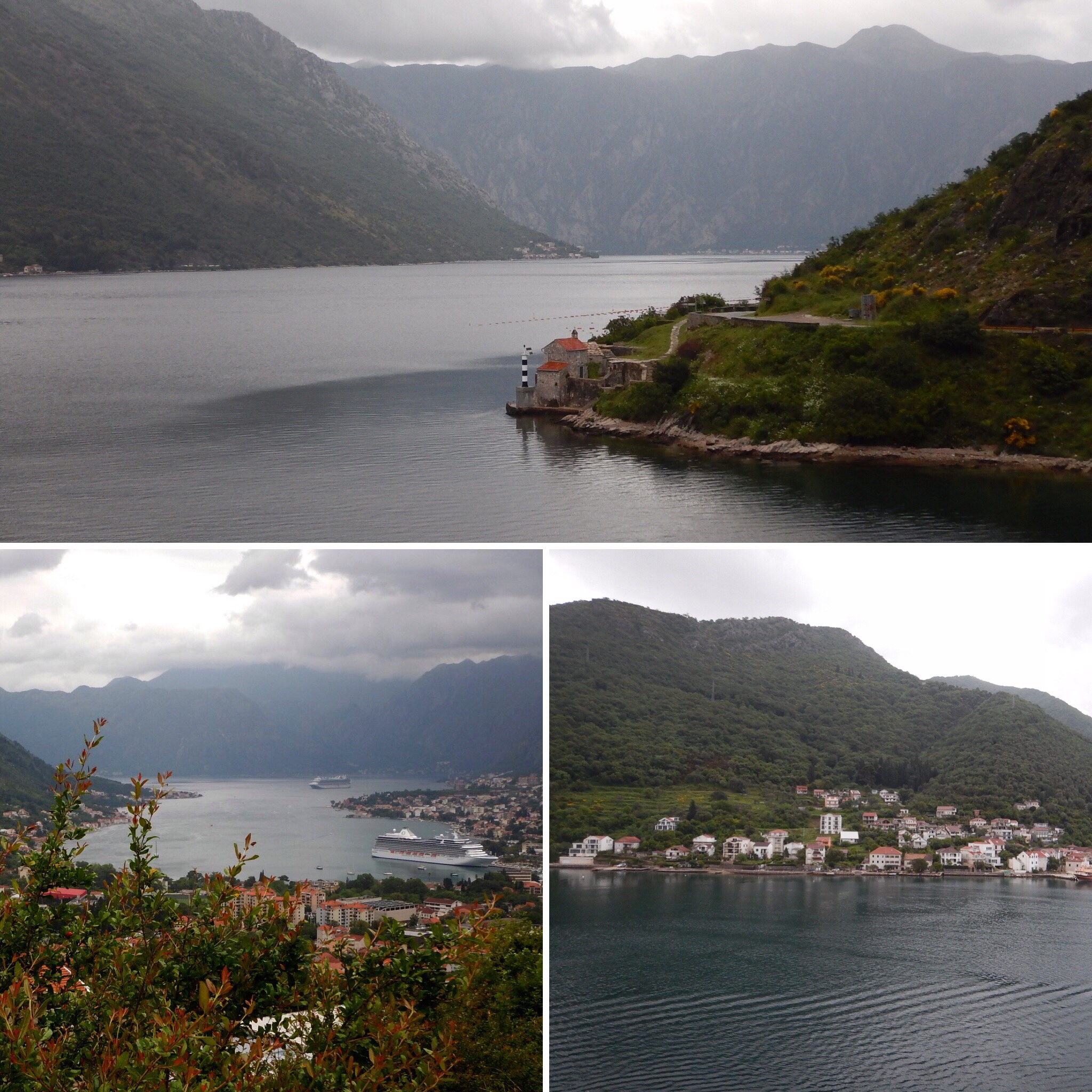
Top: leaving the Adriatic Sea and going into the fjord

Bottom-left: Kotor from mountains (our ship is the tiny one in the distance)

Bottom-right: Kotor from our ship

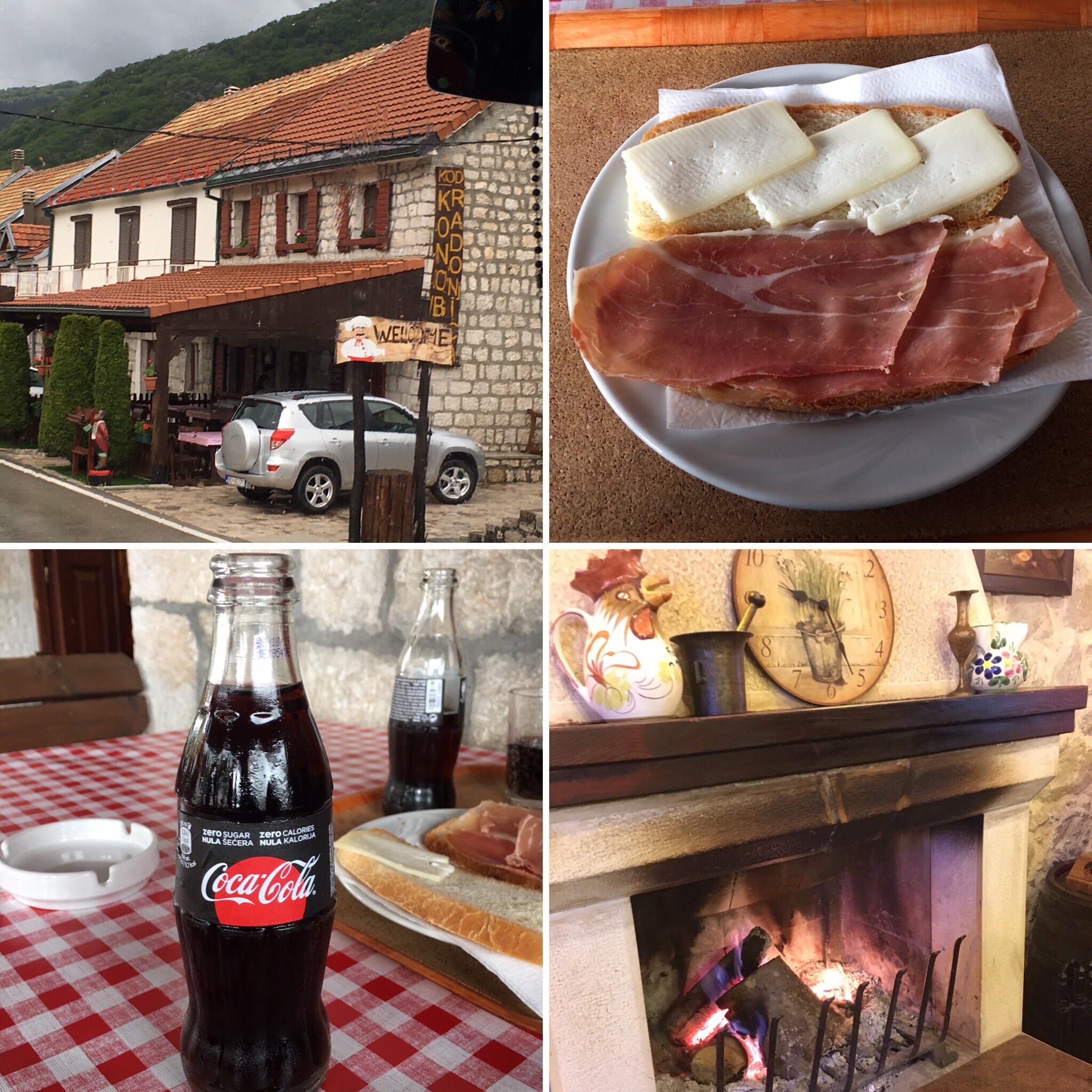
We boarded our motor coach and headed up the 1000 m (3000+ ft) mountains. The road we traveled on was a 19th century road finished in 1876 with 25 hairpin, or serpentine, curves! It was a two-way road and some of the turns were very tight!

Montenegro was an independent democratic country (1878), but it lost its independence and became part of Yugoslavia. It regained its independence in 2006. It is not a member of the EU, but a member of NATO. The official language is Montenegrin, which has Slavic roots. It is a 13,812 sq km country with 650,000 people living here. 70% of Montenegro is mountainous with many peaks approximately 2,000 meters high. Religion: 70% Christian Orthodox; 13% Catholic; 3% Muslim and the rest are minorities. Religious tolerance is practiced here. All are considered equal and inter-religious marriages are accepted without problem.

We stopped at a little restaurant in Njegusi in the mountains for a delicious snack of fresh bread, prosciutto, cow cheese and Coke Zero!! It had a nice fireplace for warmth, and different kinds of smoked meats hanging from the ceiling! Beech wood is used to smoke the meat since that wood does not add any flavor or smell to the meat.

In Cetinje, We visited the Museum of King Nicholas (only king of Montenegro), but were not allowed to take any photographs inside the museum. It was formerly the palace of King Nicholas, so we saw the study, bedrooms, dining areas, and guest rooms of the palace. We also saw wedding gowns, uniforms of the king, weapons, military decorations, dishes, and silverware. Several portraits of the family, included the King and Queen and eleven of their twelve children, plus other European rulers, such as the Romanovs, adorned the walls.

Kotor

The city was named for the many fountains that once provided water for the people. There are nine city squares named for the items that were sold in them. Ex: Fish Square; Meat Square. Since the Venetians once ruled this area, there is a heavy Venetian influence The symbol of Venice, a lion holding a book that is closed, means Venetians ruled alone. In Kotor, there is a lion with an open book which meant the Venetians ruled, but they had help from families in the town. Kotor is a city that is walled, and it has three gates. The clock tower is in the main square, and in front of it is the “pillar of shame.” Apparently, if you were guilty of a sinful act (stealing, inappropriate behaviors, etc.), your hands would be tied around the pillar where villagers could see you and pelt you with tomatoes, apples, etc. to help encourage you to not engage in that behavior again!

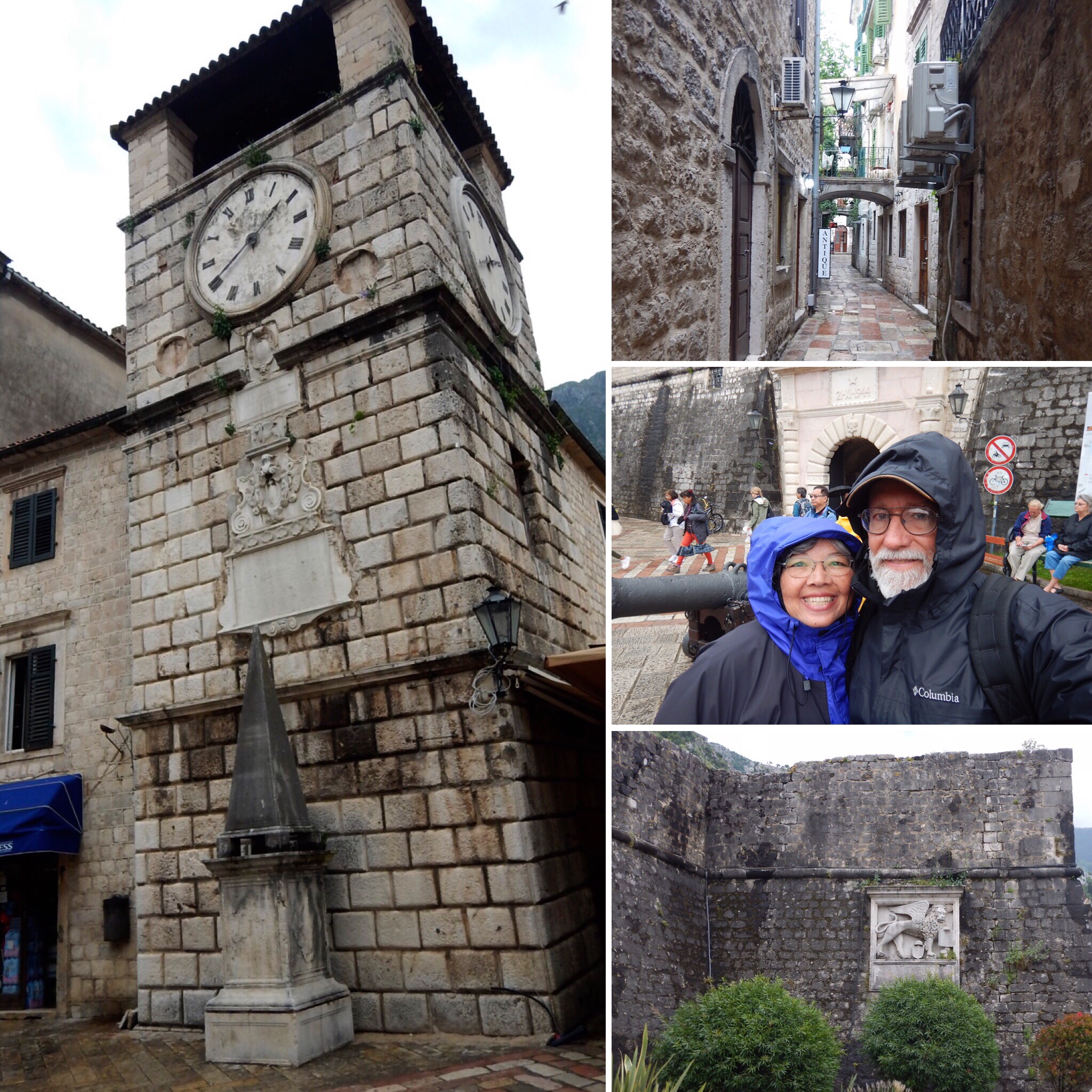
Left: clock tower and “pillar of shame”

Top-right: barrow street

Center-right: in front of main city gate

Bottom-right: city walk with Venetian sign

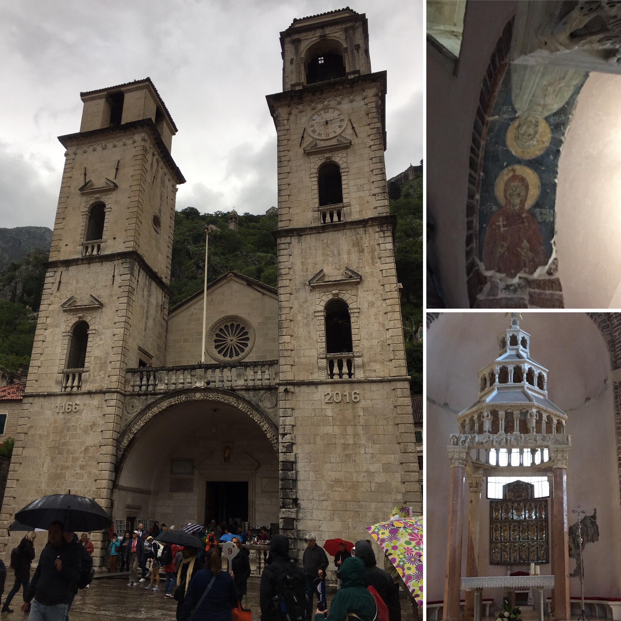
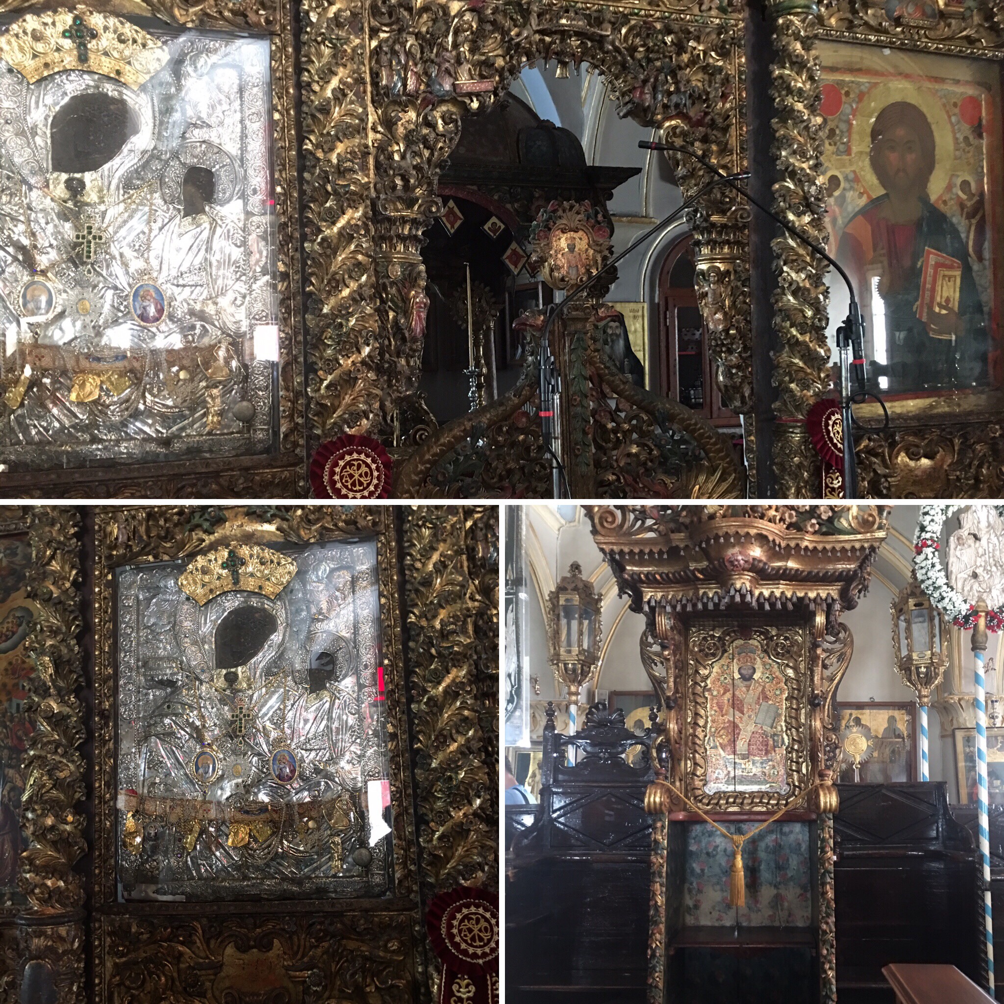
St. Tryphon Basilica

St. Tryphon was an Asian martyr killed by Romans for preaching Christ (ca 89 AD). St. Tryphon’s body was placed in this basilica to protect the town. Every February, people of all faiths celebrate St Tryphon by parading his body through the town of Kotor. Inside the basilica, there are frescoes in this basilica which is unusual in Catholic churches.

Churches Square

St Luca is an orthodox Christian church without pews, which is common in orthodox churches. St Nicholas’ orthodox church is also in this square.

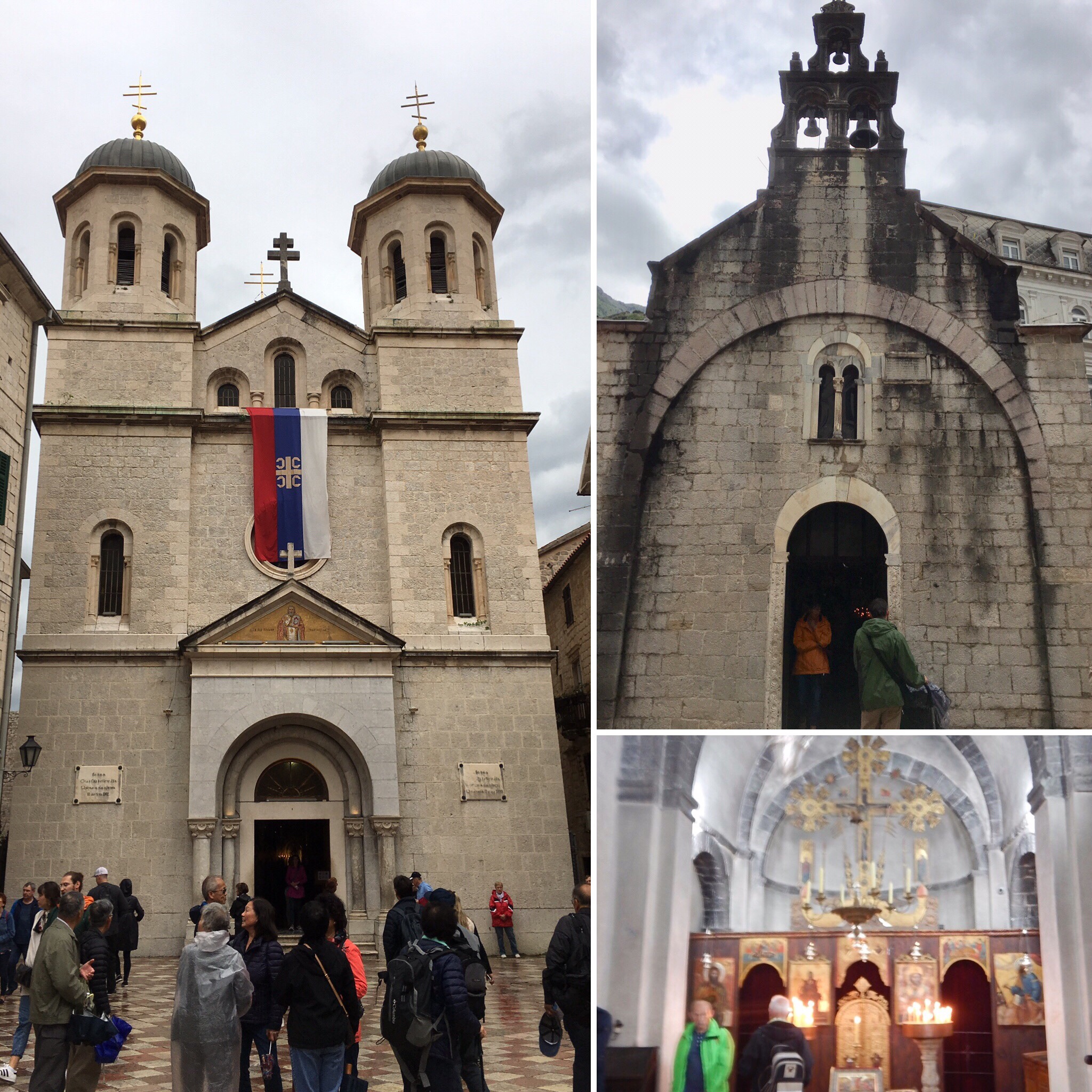
Left: St. Nikola’s church

Top-right: St. Luca’s church

Bottom-left: inside St. Luca’s

The Lady of the Helps Church

This is the little church on the mountainside. You must climb approximately 1300 steps to reach it. Continuing up the mountain will take you to St. John’s Fortress at the top of the mountain beyond the church.

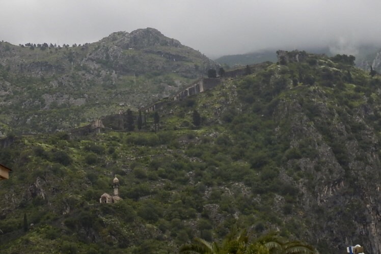
The church is on the lower left, and St. John’s is at the far top-right. The city wall can be seen above the church heading up to the fortress.

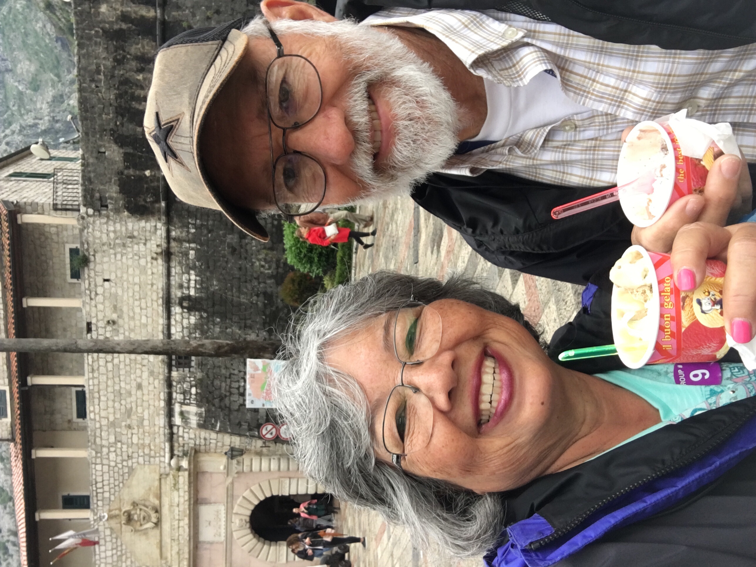
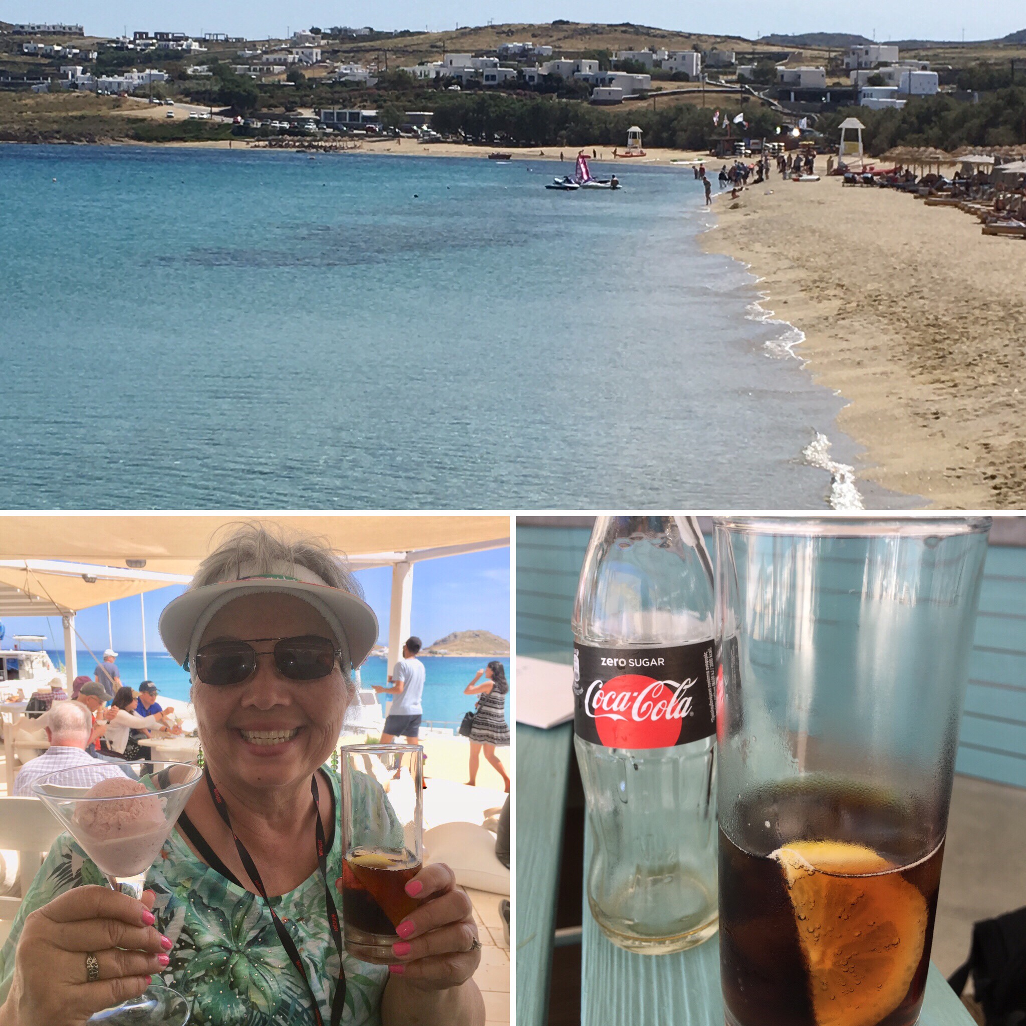
Last, but certainly not least, we had to compare Montenegrin gelato to Italian gelato. While Montenegro’s gelato was certainly tasty, Italy’s gelato was much creamier!

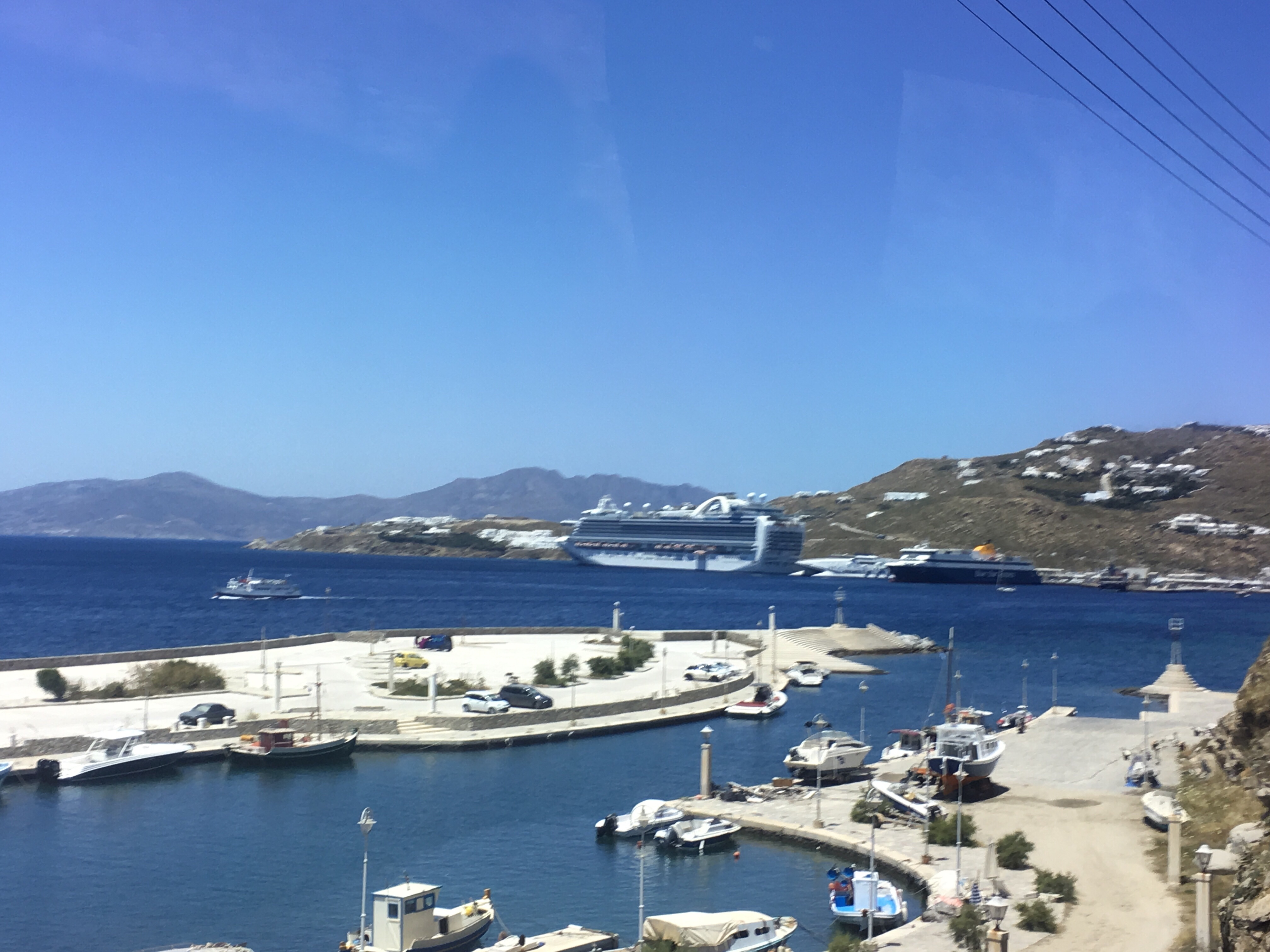
We left Montenegro through the same fjord we entered. These were some of our last sites of Montenegro as we headed out into the Adriatic Sea.

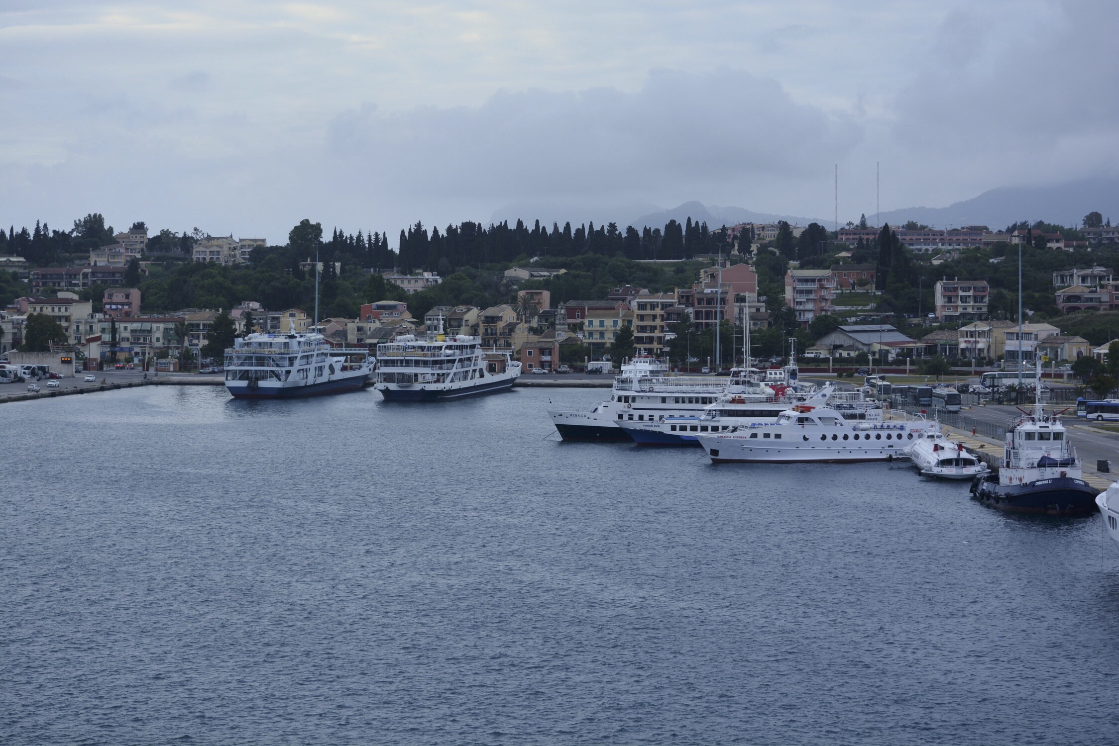
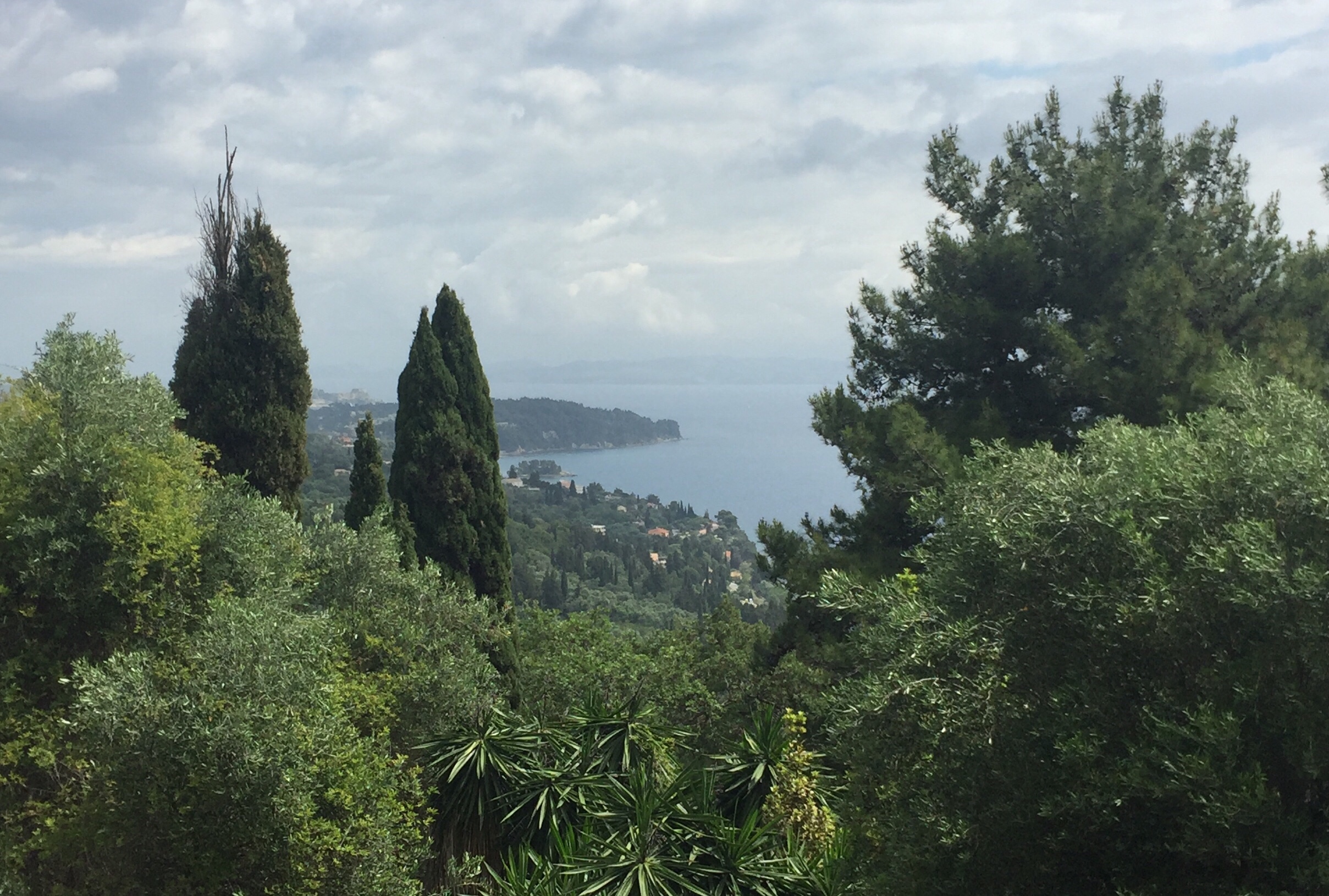
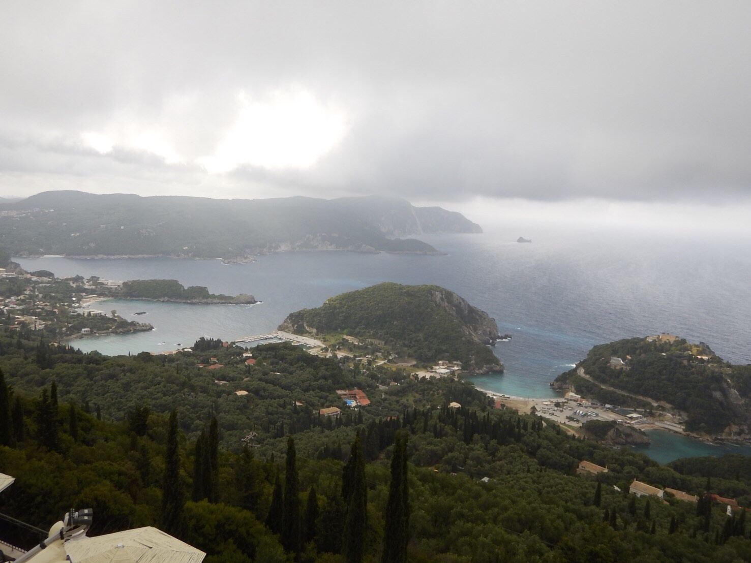
Next stop: Corfu, Greece

Civitavecchia, Italy

“But I am like a green olive tree in the house of God: I trust in the mercy of God for ever and ever.” Psalm 52:8

What a lovely day to visit the Tuscan countryside! Cool temperatures (60s-70s) and blue skies greeted us this morning.

Built in the second century, this city is about one hour northwest of Rome. It is the largest port in central Italy and the gateway to Sicily and other Italian islands.

Tuscania

On our way to our first excursion, we drove through the countryside where we saw many olive tree groves. Olives are the main crop in this area, but watermelons, artichokes, and tomatoes are also grown here. The city of Tuscania is located north of Civitavecchia, and it is of Etruscan origin. The Etruscan people were great sailors and traded with Greeks, Egyptians, and Phoenicians. Olive oil and wine were what they most often traded. Etruscans believed in an afterlife and left valuable objects in the “necropolis,” or city of the dead (cemetery). Eventually, the Etruscans were conquered by the Romans and assimilated into their culture. During our time in Tuscania, we visited the medieval section of the town and walked on its cobblestone streets. Lavello Tower, a large stone structure, was at the end of the main cobbled street and at the top of St. Peter’s Hill. Gazing out over the stone walls surrounding the area, we saw an old church and various other ancient structures on a not-too-distant hillside.

Clockwise from top-left: Lavello Tower; city wall of medieval Tuscania; Cathedral of San Giacomo Maggiore; view from Lavello Tower; old church; residence in Old Tuscania; city wall corner section; at the top of St. Peter’s Hill.

Valentini Olive Farm Visit

Meandering through the Tuscan countryside, we followed a narrow road to the Valentini Olive Farm. Here we had a demonstration on how olives are harvested. When they are ready to be picked, they are actually raked off the branches with a special net and dropped on to a special meeting below the trees. The olives are then taken to the presses. Olives that are the first of the season to be pressed produce the oil that will become known as “extra virgin olive oil.” It is green and has the best flavor. Our visit to an olive farm culminated with an opportunity to sample the delicious oil! In addition, we had bruschetta, tomato jam, ricotta cheese, olives (of course!), and fresh bread. An added treat was a bowl of penne pasta in a savory tomato sauce. What a special treat!

Clockwise from top-left: olive trees; vineyard; tasty samples; olive oil and other snacks; demonstration of olive harvesting

Strolling through Civitaveccha was a great way to end our day. There was a beautiful walkway along the Mediterranean Sea, and we were able to see Michelangelo’s Fort as we walked. Last, but certainly not least, we found a nice place to sit, rest, and enjoy the scenery… well, maybe there was a little more incentive for John to stop at this particular place!

Top: Michelangelo’s Fort. Bottom-left: Civitavecchia Cathedral. Bottom-right: John and his gelato.

Next stop: Pompeii and Capri

Genoa, Italy

“And he saith unto them, Follow me, and I will make you fishers of men.” Matthew 4:19

Genoa is Italy’s 6th largest city, and it is surrounded by mountains and sea. Christopher Columbus was born here, and the international airport is named for him. In the past, there were 20 fortresses protecting the city in the mountains, and a Genoese sea army protected it from ocean attacks.

Today we traveled by boat to Portofino, Santa Margherita, and Camogli, three coastal villages. As we headed out of the port of Genoa, we saw several of the forts on the nearby mountains. As we sailed, we passed San Fruttuoso – an abbey nestled at the base of coastal mountains on the beach. It was originally built by monks, but it is no longer a monastery. Today, it is a museum and public beach.

We then sailed around the Portofino lighthouse and saw beautiful multicolored homes on the hillside. We also passed by the Nature Park of Portofino, a protected area since 1945.

Santa Margherita

Santa Margherita was our first coastal village. Right at the end of our pier, was a park with lots of statues including a green statue of the first king of Italy, Vitorrio Emanuele. We walked to the Center Square of Santa Margherita and saw its 1st church dedicated to St. Margaret. It is a 17th century church – Baroque style architecture. Frescos, floors and side chapels use colored marble, and there are also paintings that decorate the church.

Clockwise from top-left: Santa Margherita bay; Columbus statue; Santa Margherita church; Santa Margherita statue

After visiting the church, we strolled through the narrow streets and saw pasta making shops, cheese and salami shops, candy and pastry shops. And then we saw it! A gelateria! Time for our first gelato! John had dark chocolate, and I had pistachio. What a glorious treat!!

Clockwise from top-left: cookies and spreads; sampling our first gelatos; fresh produce; tourist shopper; making fresh ravioli

Portofino

Portofino is a fishing village on the western shore of Italy near Genoa. The houses here are different colors, so the fishermen at sea could easily identify which house was theirs. St. George is the patron saint of Portofino. St. George’s church was destroyed in WWII, then rebuilt. The view from the church was awesome.

We had independent time, so off we went. Guess what John found? Another gelateria! And he found his favorite flavor: stracciotella (chocolate chip)! He has found his souvenir, and I being a supportive wife had to have another one too! Delish!

Camogli

Our last village was Camogli. On our way, the boat cruised by the abbey again in the Nature Park of Portofino. Camogli is a small fishing village that is definitely not a tourist spot. We did find a place that sold focaccia, pizza, and brioche, so we bought a focaccia with tomato and olive oil. It was really delicious! This is a very hilly town, and John wanted to know what the upper street was like, so off he went! I documented his quest from down below! Finally, he came back, and we headed back to the waterfront. However, we had one more stop – a gelateria!

Left: stairs to adjacent street. Top-right: sampling focaccia. Bottom-right: chocolate gelato.

Next stop: Florence and Pisa!

Gibraltar

“…Lead me to the rock that is higher than I.” Psalm 61:2b

Gibraltar is an overseas territory of the United Kingdom and has been so since 1704 when the British defeated Spain in the War of Spanish Succession. Gibraltar is located on the southern tip of the Iberian Peninsula, and lies at the entrance to the Mediterranean Sea. It is a very small country (less than 3 square miles), but very diverse in its population of 30,000. The famous Rock of Gibraltar is the limestone sentinel that stands watch over the Straits of Gibraltar, the waterway link between the Atlantic Ocean and Mediterranean Sea. Located at the southernmost peak of Gibraltar, Europa Point is the “end of Europe.” From here you can see northern Africa and Spain. According to Greek legend, Hercules held on to Gibraltar, the “pillars of Hercules,” when he pulled Africa and Spain apart.

On the bottom photo, the mountains of Morocco are visible on the left, and on the right is Spain.

St. Michael’s Cave is a limestone formation with many huge stalagmites and stalactites throughout it. Illuminated by colored lights, it gives a surreal feeling to a “naturally formed” cave. The cave opens up into a huge amphitheater which is actually used for musical concerts!

Perhaps one of the most well known attractions in Gibraltar are the Barbary Apes. They are not really apes at all, but instead they are tail-less monkeys! They are actually named the Barbary Macaques. No one really knows how they got here, but there are about 250 roaming freely in Gibraltar. One unusual fact about the Barbary apes is that the fathers help care for their young! Winston Churchill is known for saying that as long as there were the monkeys on Gibraltar, it would remain in the British empire.

The Gibraltar airport has its main and only runway crossed by a city street and pedestrian walkway. The airport is considered the 4th most dangerous airport in the world because westerly winds create increased turbulence here. If after three attempts, a plane cannot land due to the turbulence, it is redirected to Malaga, Spain for landing, and the passengers are then shuttled back to Gibraltar.

Clockwise from top-left: airport control tower; standing on the runway; on runway with “The Rock” behind us; a “plane” landing

Next stop: Marseilles, France

Barcelona, Spain

“All the ends of the world shall remember and turn unto the LORD: and all the kindreds of the nations shall worship before thee.” Psalm 22:27

Barcelona is the beautiful capital city of Catalonia, a region of 1.7 million people. It was here that Columbus returned from the New World to meet with Queen Isabella. Barcelona is known for many things, such as the 1992 Olympics and the childhood home of Pablo Picasso.

Cathedral of Barcelona

This cathedral was built on the style of gothic architecture as shown by the pointed arches.

La Sagrada Familia

This church was designed by Gaudi, a famous Catalán architect. Construction began in 1882, and the current plan is for it to be completed in 2026. The central tower, which represents Jesus, will eventually be 110 meters tall. The nativity facade in the front of the church is the only one actually built by Gaudi

before he died. The life of Christ is depicted in the facades around the church. His birth and childhood is on the east side (where the sun rises), and His death and resurrection is on the west side of the church (where the sun sets).

Clockwise from top-left: cathedral; marriage of Joseph and Mary; nativity; fleeing to Egypt

The cypress tree represents eternal life, and the different fruits represent the twelve months of the year.

Clockwise from top- left: cathedral spirals; crucifixion; cypress tree with fives; fruits on top of arches.

Other Barcelona highlights

Clockwise from left: statue of Columbus; site of the palace of the Spanish Inquisition; Picasso artwork; Roman arch and aqueduct; Arc del Triomf

Next stop: Gibraltar

Malaga, Spain

“Kings of the earth, and all people; princes, and all judges of the earth: both young men, and maidens; old men, and children: let them praise the name of the LORD: for his name alone is excellent; his glory is above the earth and heaven.” Psalm 148:11-13

To reach Malaga from Cadiz, we had to sail through the Straits of Gibraltar, leaving the Atlantic Ocean and entering into the Mediterranean Sea. As we passed through the Straits, just after midnight, there was a lighted sign on a hillside that said “Gibraltar Cliffs.” The photo is not clear, but the large white blur on the right is the sign.

We arrived in the early morning at the Port of Malaga. The skies were clear and blue, and it promised to be a beautiful day for us. We had a 1.5 hour drive to our destination, the city of Granada, so we were among the first to disembark for our tour. We began with a beautiful drive along the shoreline in Malaga. As we left the city and entered the countryside, I couldn’t help but notice that the terrain was very similar to that of southern California. It was dry with small shrubs, a few oaks. As we got farther from Malaga, we entered the agricultural area with orchards of olive and citrus trees, the same kind of scenery I remember seeing on highway 126 through Santa Paula, California. The hills outside of Malaga are covered with olive trees because apparently they grow very well in hilly regions, and Spanish olive oil is highly valued.

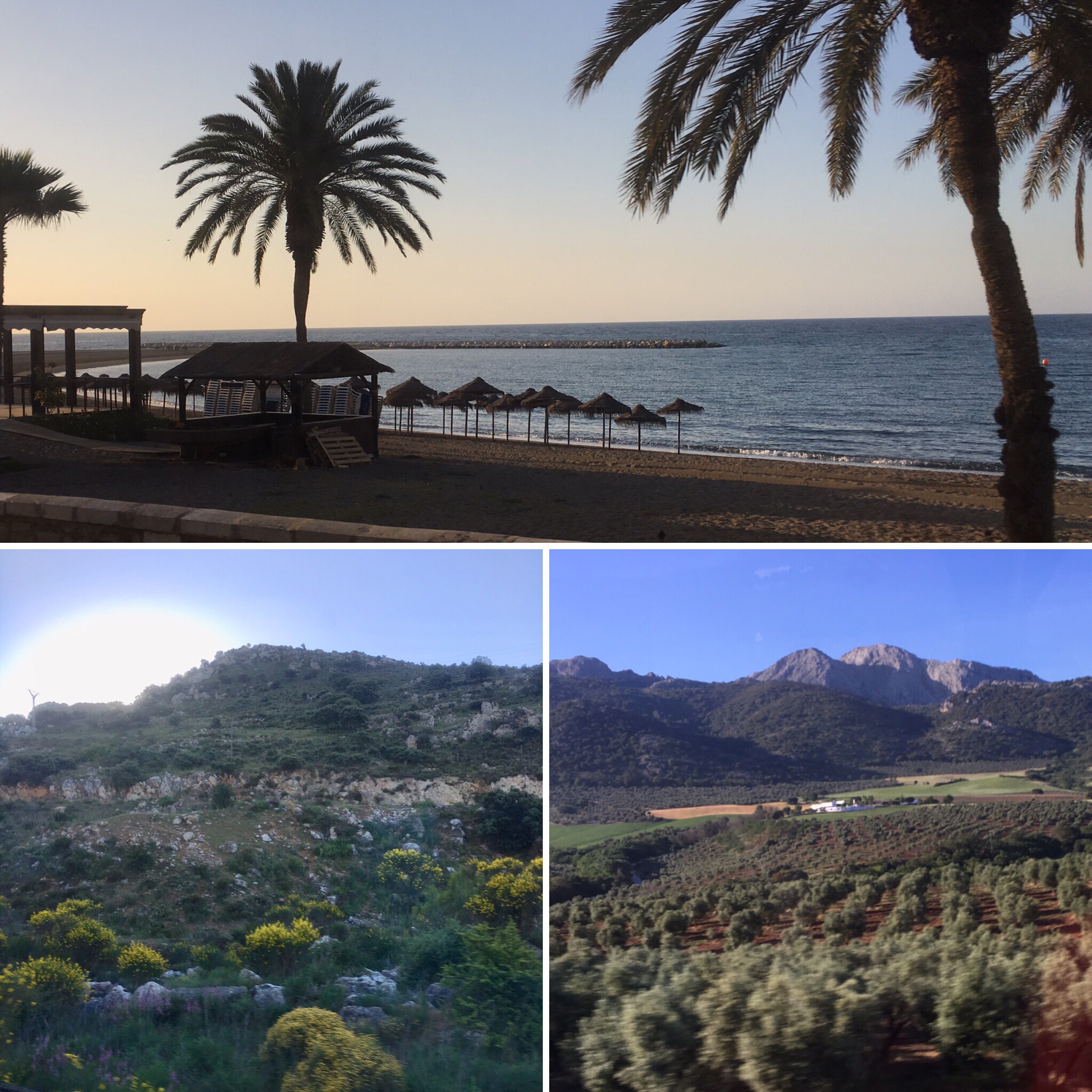
Malaga beach (top), countryside (bottom left), olive trees (bottom right)

Granada

Historically, Granada was the last independent kingdom before Spain became a unified country under King Ferdinand and Queen Isabella. Symbolized by the pomegranate, it is bordered by the Sierra Nevada Mountains, making Granada is a popular tourist attraction that nomads once referred to as paradise. Nearly 280,000 people now call Granada home.

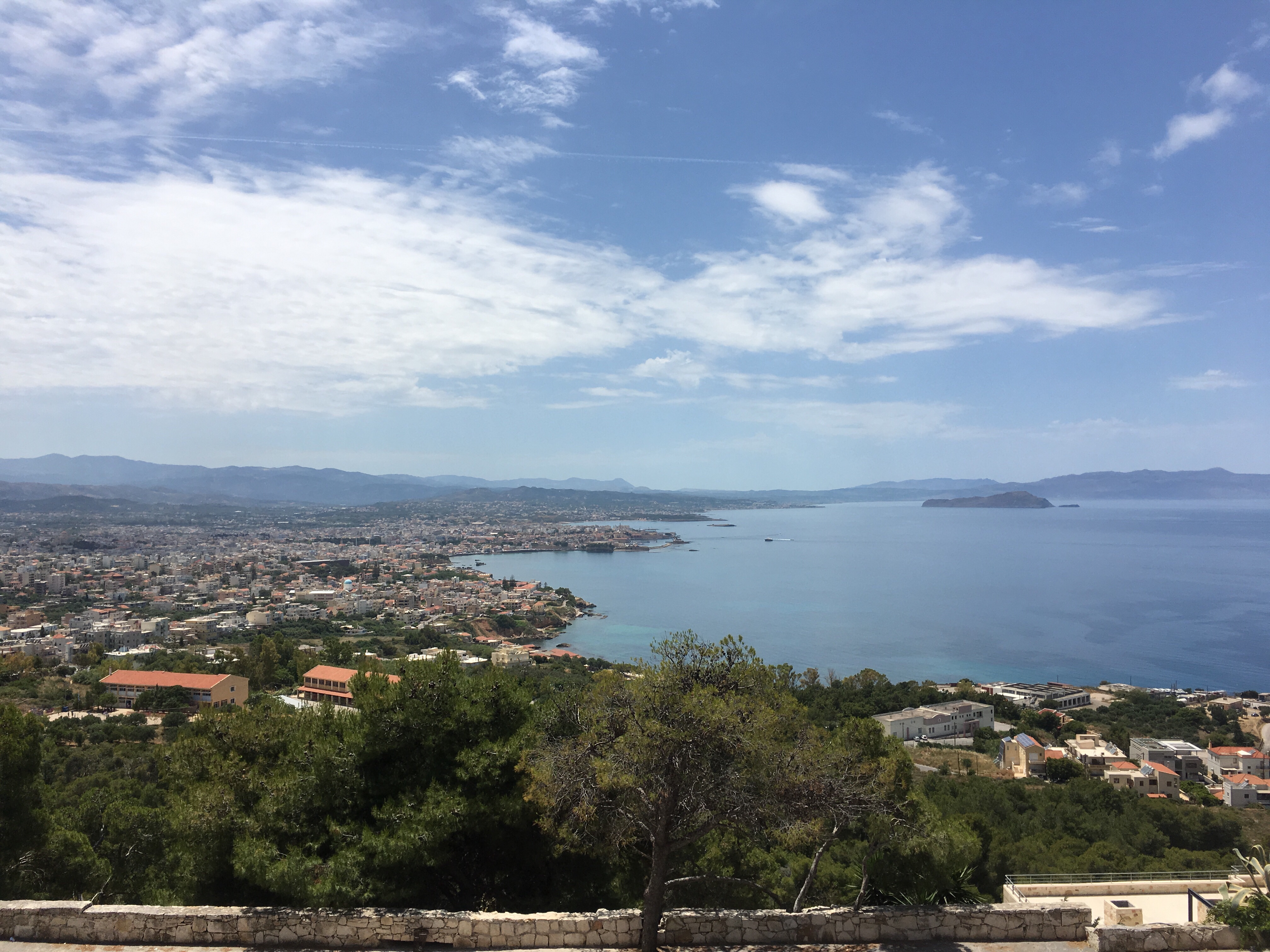
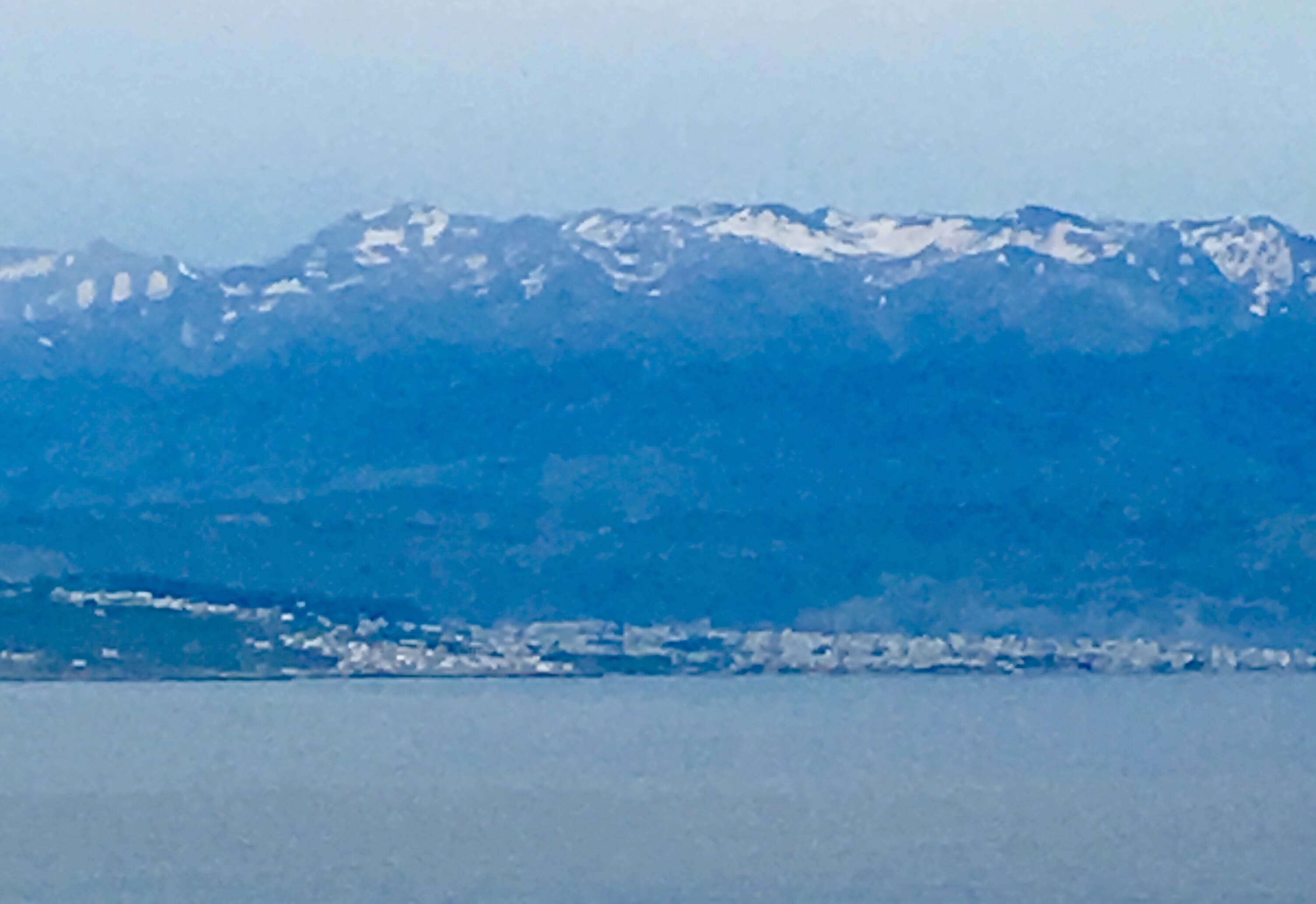
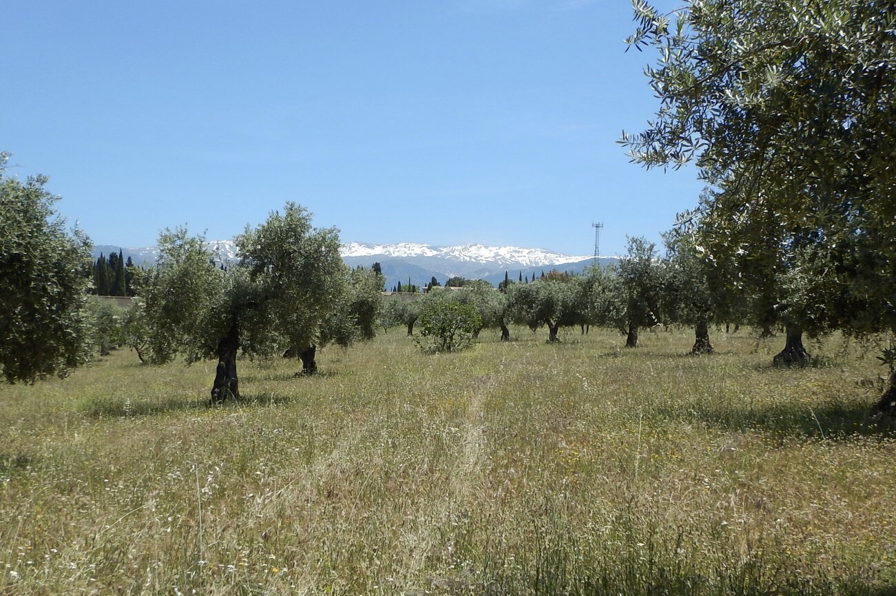
The Sierra Nevada mountains can be seen beyond a grove of olive trees.

*Royal Chapel

This is the burial place of King Ferdinand and Queen Isabella. They wanted Granada to be their final resting place because it was their dream that Spain be unified, and Granada was the last independent kingdom.

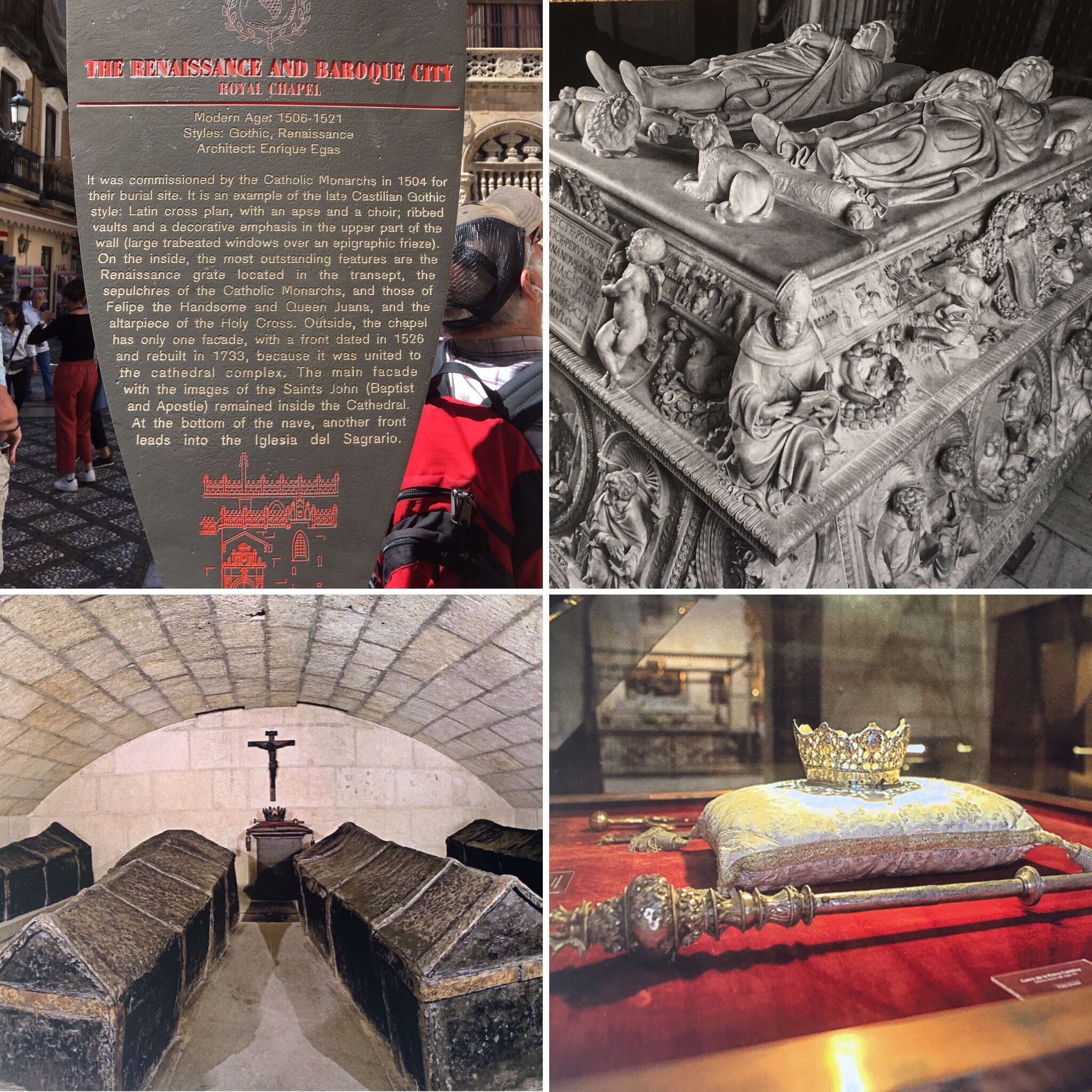
From top-left, clockwise: Royal Chapel sign, Top of mausoleums, actual remains inside the tomb, Isabella’s crown and scepter
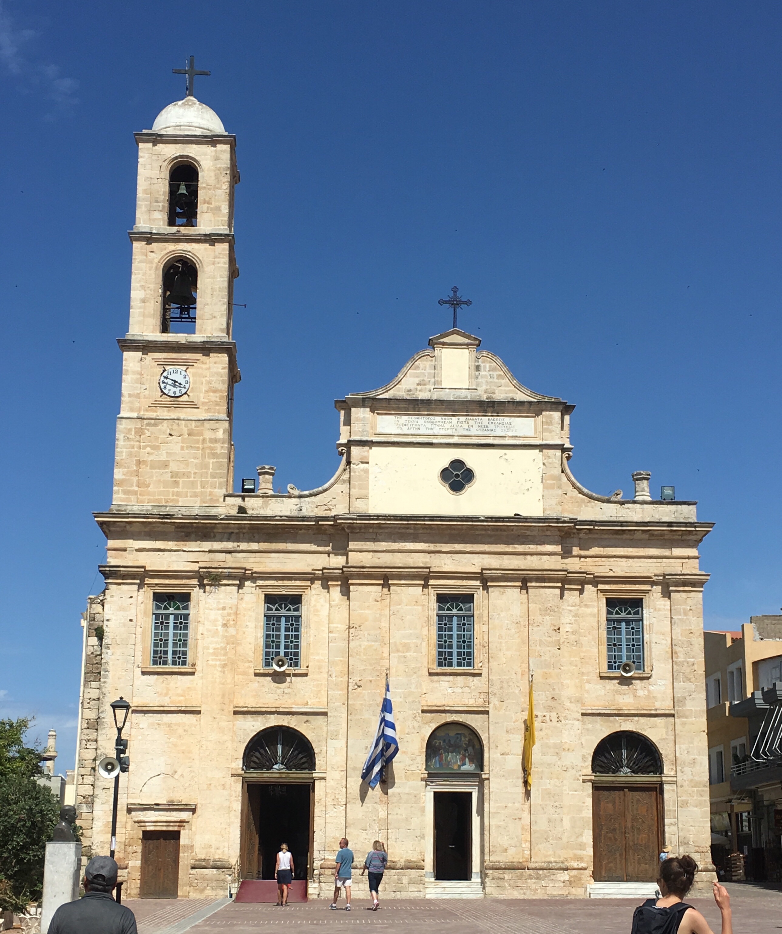
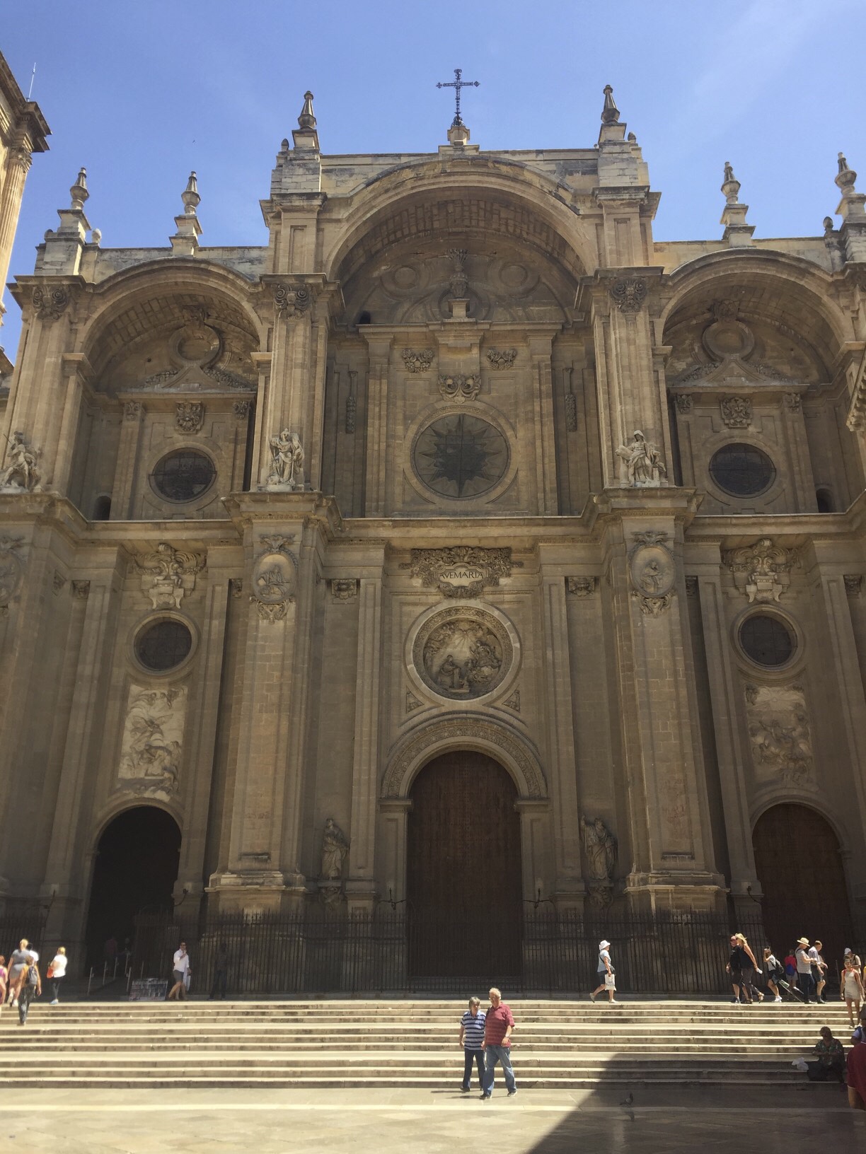
*Cathedral of Granada

It took 200 hundred years to build this cathedral, and as such it has two basic architectural styles: gothic and baroque. Its construction was commissioned by Philip, the grandson of Ferdinand and Isabella, and its interior looks more like a palace than a traditional cathedral.

Cathedral exterior

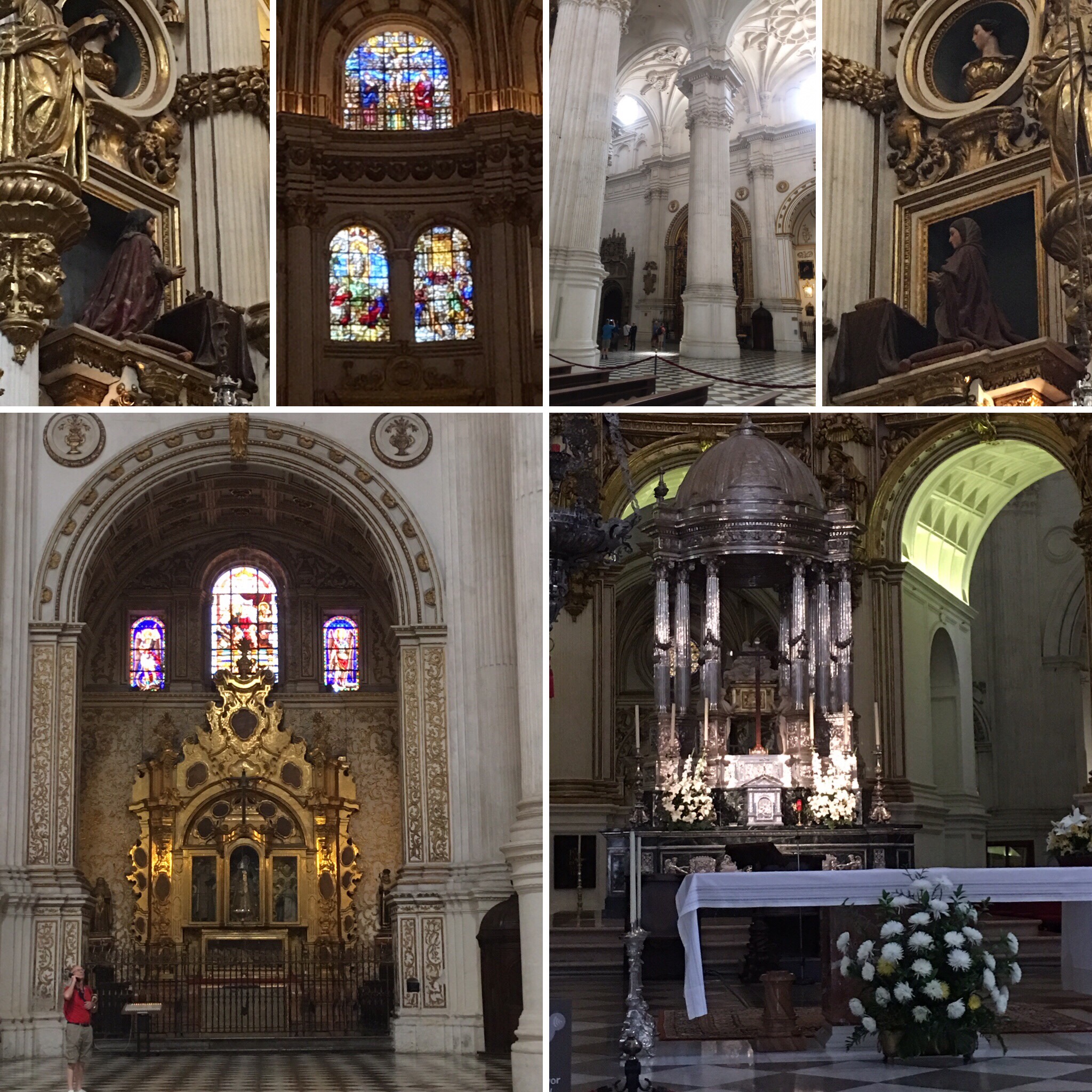
Clockwise from top-left: King Ferdinand (father of Spain) praying below Adam (father of mankind); stained glass; marble pillars; Queen Isabella (mother of Spain) praying below Eve (mother of mankind); altar area; alcove

*Alhambra

This was a fort built by the Moors around the 9th and 10th centuries to protect their communities. It is on a hill that overlooks the city of Granada in the Muslim quarter of the city.

The steep, cobblestoned road we climbed to get a view of the fortress led us by a variety of shops and sights. Arabic influence was evident throughout this section of the city in the streets, shops, and architecture.

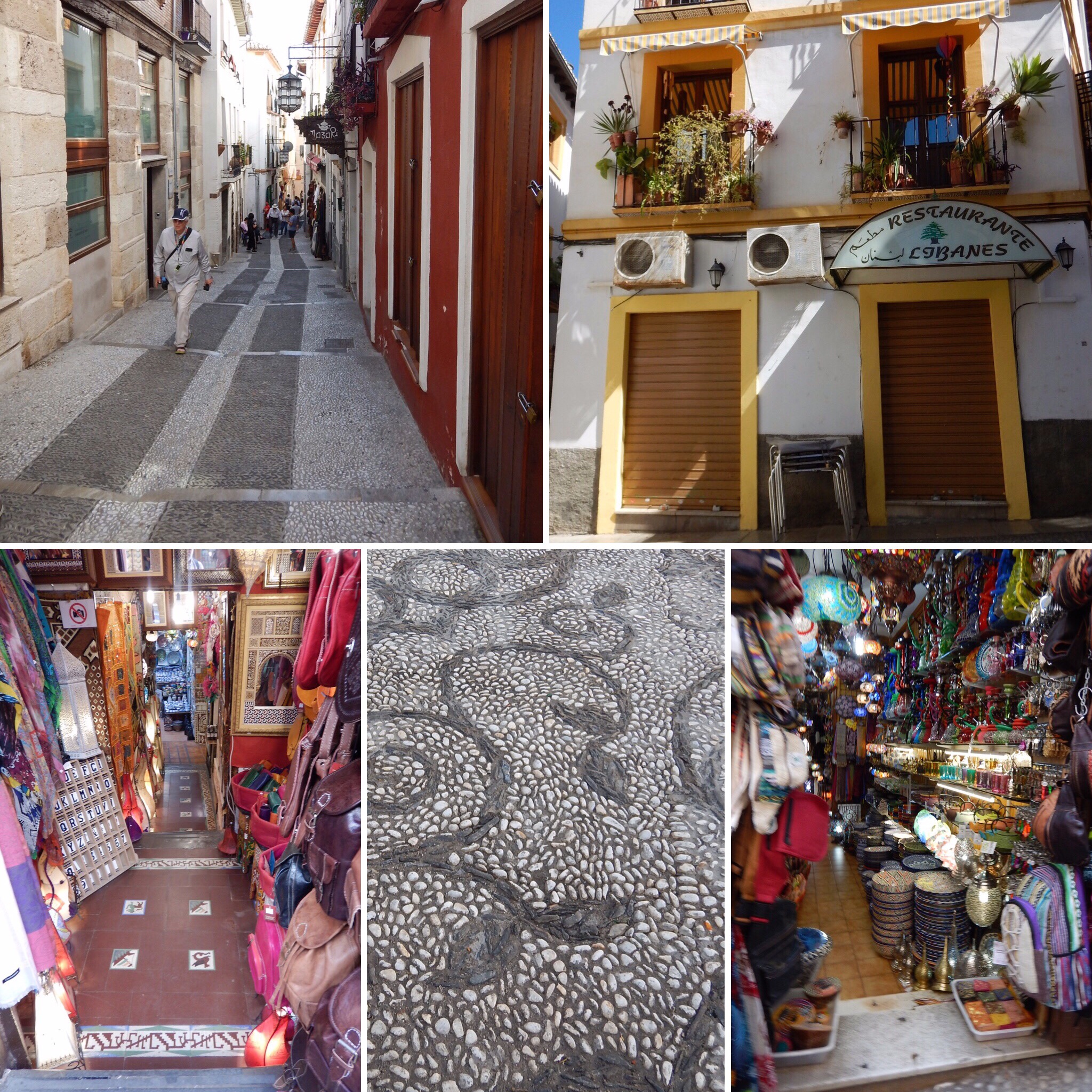
Clockwise from top-left: steep, cobbled road up to viewpoint; restaurant; shot; detail of cobblestoned road; another shop

Next stop: Barcelona, Spain

Cadiz, Spain

For the preaching of the cross is to them that perish foolishness; but unto us which are saved it is the power of God.” 1 Corinthians 1:18

Cadiz was founded 100-150 years before Christ by Phoenicians. Today, there are about 200,000 people. It is located on a peninsula where two bridges link city to mainland. We crossed the 3 km long Constitution Bridge as we left the peninsula and headed toward Seville. Spain is a land heavily influenced by the Muslims, who had been on the Iberian peninsula for 800 years until Christians conquered the land.

Seville, Spain

Today the area around Seville is known for its sherry wine. It’s quality doesn’t depend on the year, but rather upon the taste of the “mother of the wine.” The oldest wine in the wine cellar is the “mother” and is mixed with the younger wines when they are being made. The darker the wine, the sweeter it is.

*In preparation for the Exposition of 1929, countries that participated built elaborate buildings representing themselves. Those buildings still remain, and many now are used as cultural centers for those individual countries.

*Casa de Pilatos – Pilate’s house

This was not actually Pilate’s house since it was built in the 15th century. Instead, the son of wealthy family visited Jerusalem and wanted to build this palace to commemorate the “stations of the Cross.” Pilate’s house (Praetorium) in Jerusalem is the first “station of the Cross,” which this palace was to represent. The architecture is similar to Arabic architecture (wood-plaster- mosaics) except instead of mosaics, ceramic tiles are used to cover the walls.

Clockwise from upper left: metalwork archway leading to courtyard (center); bust of Vespasian; Roman helmet; architecture; chapel; Spanish garden; goddess Artemis; Italian garden; courtyard.

*Cathedral de Sevilla

Currently being renovated, this is the world’s largest gothic cathedral, and it is here that the archbishop lives.

The bottom left photo is Christopher Columbus’ tomb. His bones are not buried in the crypt. Instead, they are being carried above it because Columbus stayed he did not want to be entombed.

*The Old Town

We strolled through the old section of Seville, through narrow and cobbled streets. Lots of little shops, places to eat, and town squares. We stopped for lunch at the San Marco restaurant.

Top: profiteroles with chocolate sauce

Bottom left: pork with raisin gravy and scalloped potatoes. Bottom right: salad

*Spanish Square

This was built by Spain for the Exposition of 1929. Each arch represents a state of Spain, and their names are in the ceramic tiles under their arch. The water represents the Atlantic Ocean, and the bridges connects Spain with the North American continent.

Today we walked about four miles. The weather was in the low 90’s, and it was a bit humid, but all in all, it was a very interesting and educational day.

Tomorrow: Granada, Spain