Salerno, Italy

“God is our refuge and strength, a very present help in trouble. Therefore will not we fear, though the earth be removed, and though the mountains be carried into the midst of the sea; Though the waters thereof roar and be troubled, though the mountains shake with the swelling thereof. Selah.” Psalm 46:1-3

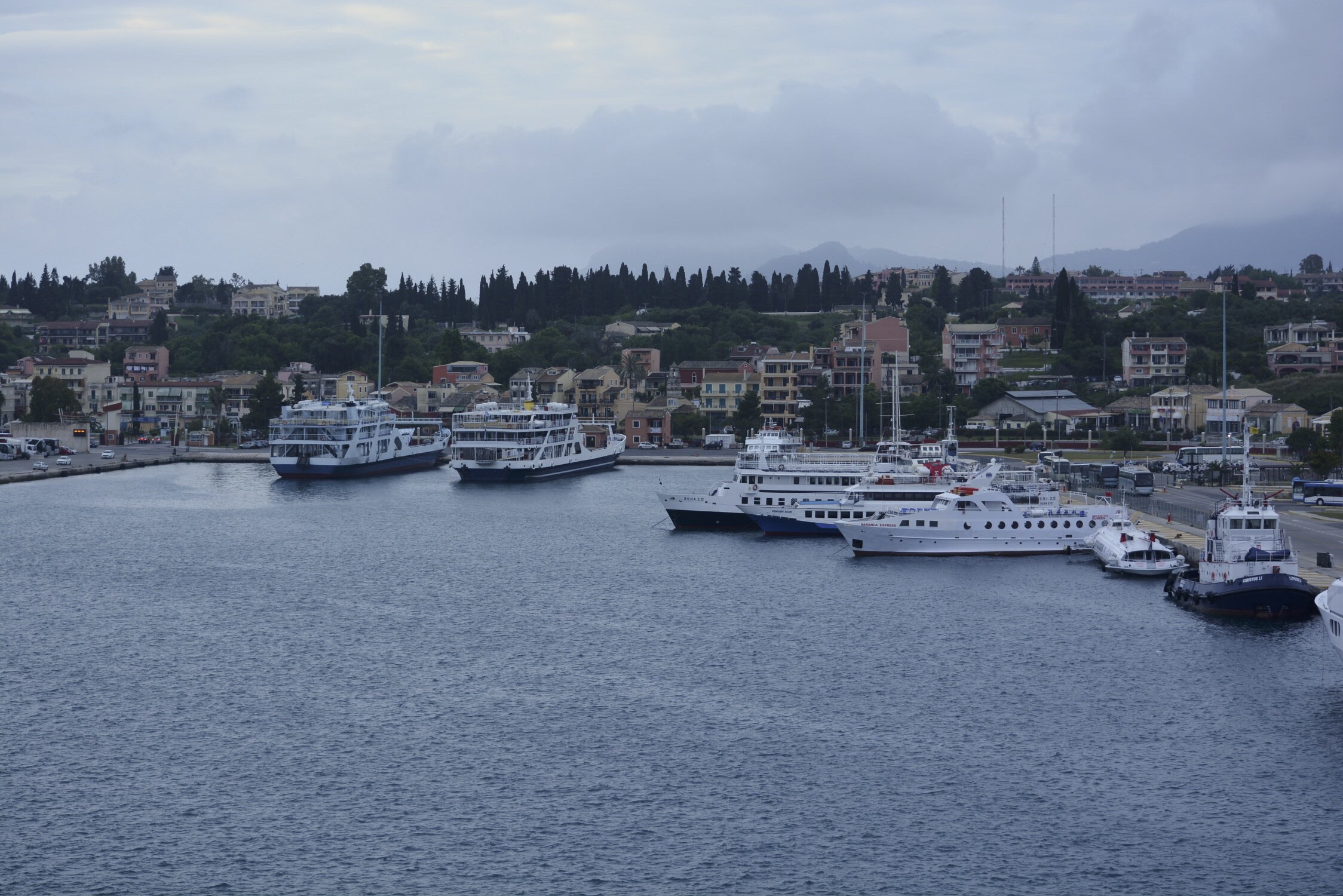
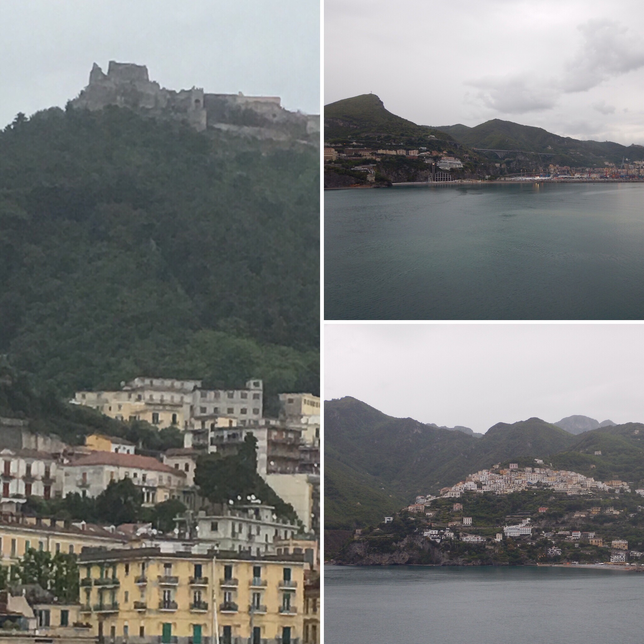
Today we awoke to overcast skies and rain! Oh no! We are scheduled for a motor boat ride to Capri, and I hope the rain doesn’t cloud our vision (no pun intended!). As we came into the harbor, we could see the 8th century Castello di Arechi (Lombard Castle) perched high on a hill overlooking the city. It was originally used as a fort. Salerno is known for having the world’s first medial school, Scuola, dating from the 10th century and the Verdi Theater, an opera theater dating from 1872!
Capri

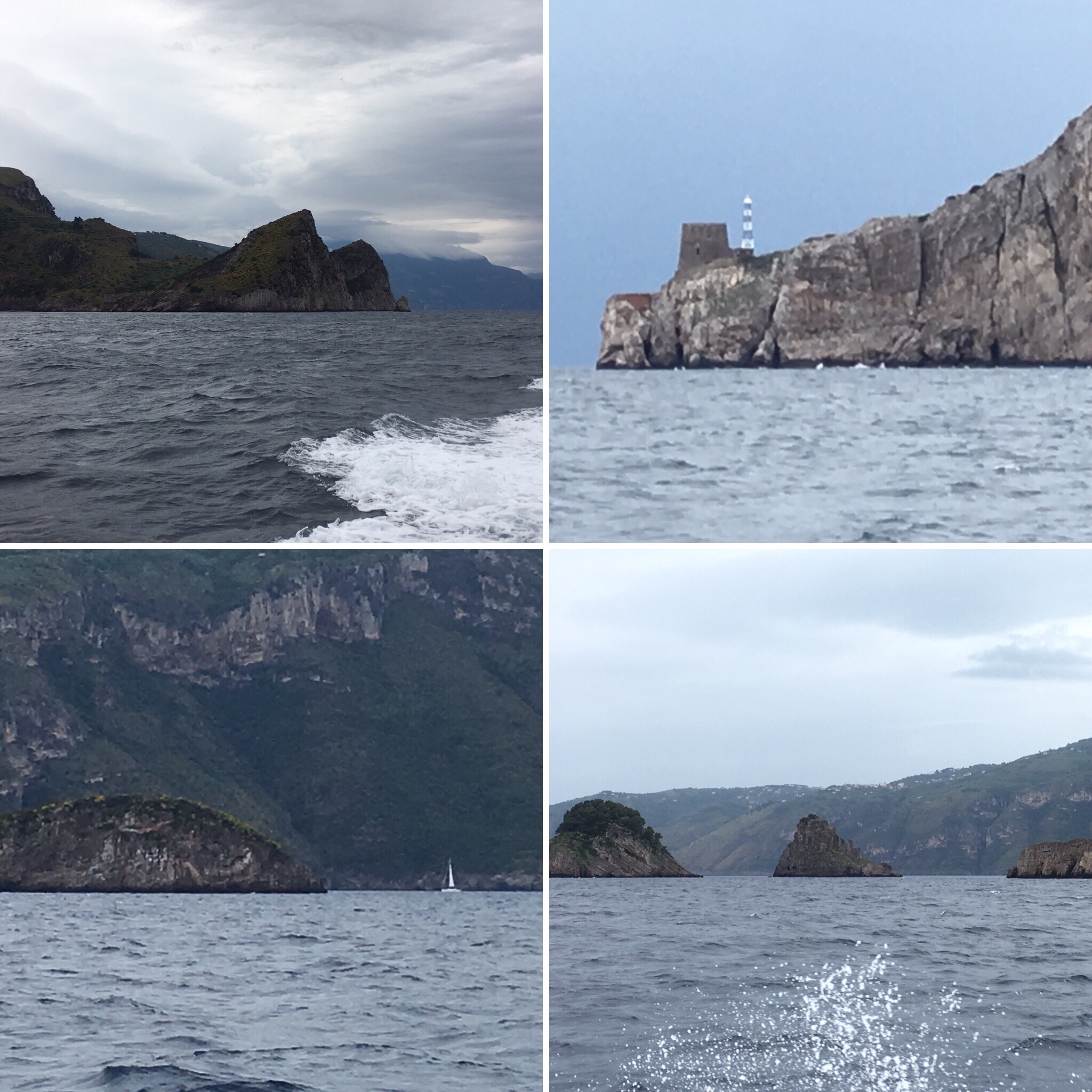
Overcast skies this morning as we approached the port of Salerno, so we packed our rain jackets today! It was steadily raining as we disembarked the Emerald Princess. We waited in the rain as our local tour guide passed out our radios before leading everyone to the boat for our hour-long jet boat ride to Capri. The trip started out quite gloomy and wet, but the rain stopped after about 45 minutes into the boat trip. The Amalfi coastline was stunning with houses dotting the rugged cliffs.

Capri is a large island just off the Sorrento peninsula that forms the southern border to the Bay of Napoli. This island was first discovered by the Greeks, but eventually it was purchased by Augustus, emperor of Rome. Later, in the latter part of his life, Emperor Tiberius came to Capri and he remained there until his death. As we approached Capri from its southern coast, we could easily see Mt. Salerno, the highest peak on the island at 1900 feet above sea level.
By the time we arrived in Capri’s harbor, the rain had become a drizzle. We rode the funicular to the top of the island where there were many different shops, a church, and the symbol of Capri – the clock tower. Most of the stores were very expensive. Names like Prada were not uncommon to see. While most places we had visited prior to Capri had many souvenir shops, here we had to search diligently before finding one. John did manage to find a gelato shop, so he was happy, and we felt it was important to sample Capri gelato! (Spoiler alert: it was amazing!)
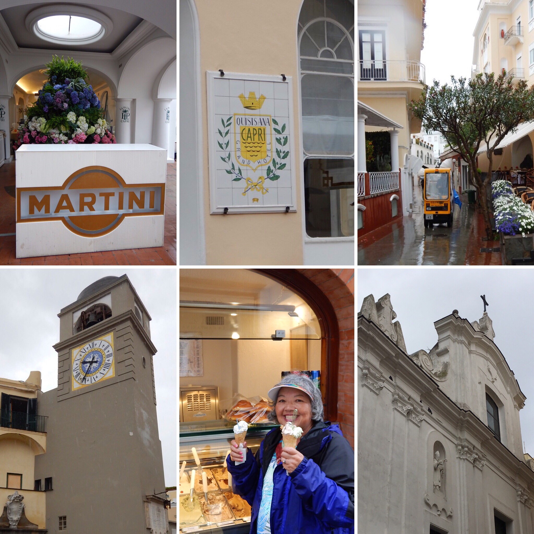
Clockwise from top-left: hydrangeas in a restaurant; $1800/night hotel; electric cars are the only transportation allowed; church; gelateria (one is for John!); clock tower

As we strolled around, we passed the Charterhouse of St. James, a monastic estate of the Carthusian order, which was founded in the 14th century by Giacomo Arcucci. No longer a monastery, it serves as both a high school and cultural center. We continued our walk to the Gardens of Augustus, which had several beautiful overlooks including one where we could see the “Faraglioni stacks,” three rock pinnacles formed over time by erosion from the wind and sea. The gardens were donated to the island by the Krupp family on the condition the gardens be free to the public. After riding the funicular back down to the harbor area, we boarded a boat for Sorrento.
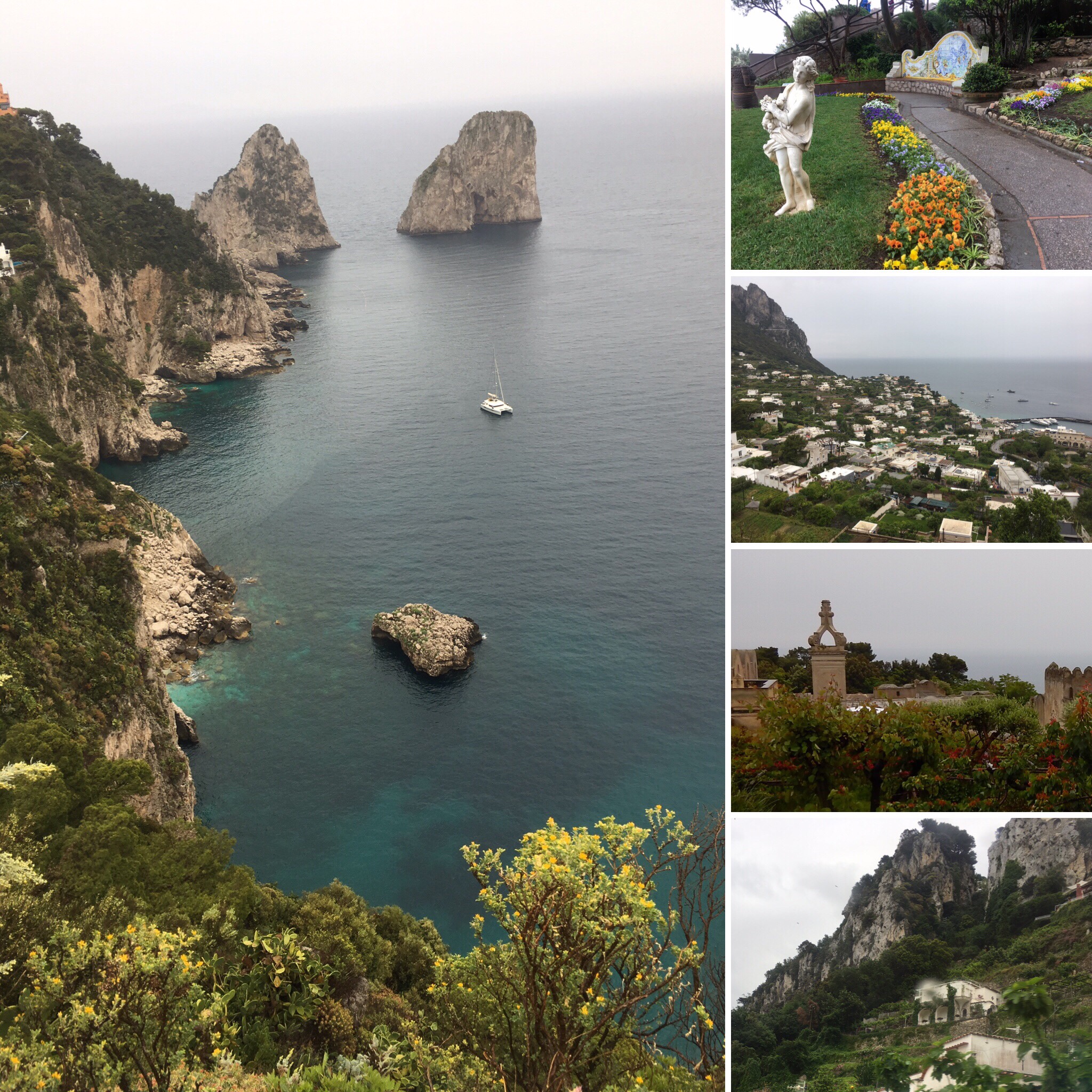
Left: Faraglioni stacks. Right top to bottom: Gardens of Augustus, town of Capri, monastery, cliffs

Sorrento, Italy

Greek legend says this town was once the home of mermaids, or the siren, who sang beautiful songs to lure sailors here to their doom. Today, 40,000 people live here in the homes built upon the volcanic cliffs. Sorrento overlooks the Bay of Naples, and from the harbor, we rode a minibus up a cobbled tightly winding road to the main part of Sorrento at the top of the cliffs. It was now pouring rain as we scurried into the Vela Bianca, our restaurant for lunch. Our table was already set with white wine, bottled water, and bread. We sat at a table for four, but no one sat with us, so we had some alone time. The atmosphere in the restaurant was very friendly, and we were hungry. Bring on the Italian cuisine!
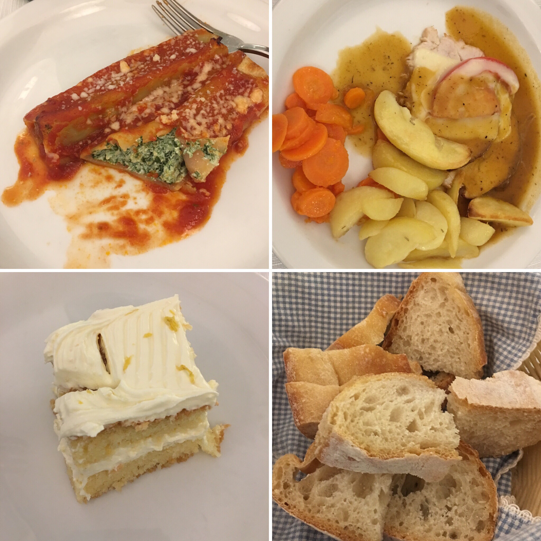
Top left: Appetizer – pasta stuffed with spinach and ricotta in a tomato sauce

Top right: Entree – Florentine (chicken) scallopini with mozzarella and tomato Bottom left: dessert – Lemon cake

Bottom right: bread basket

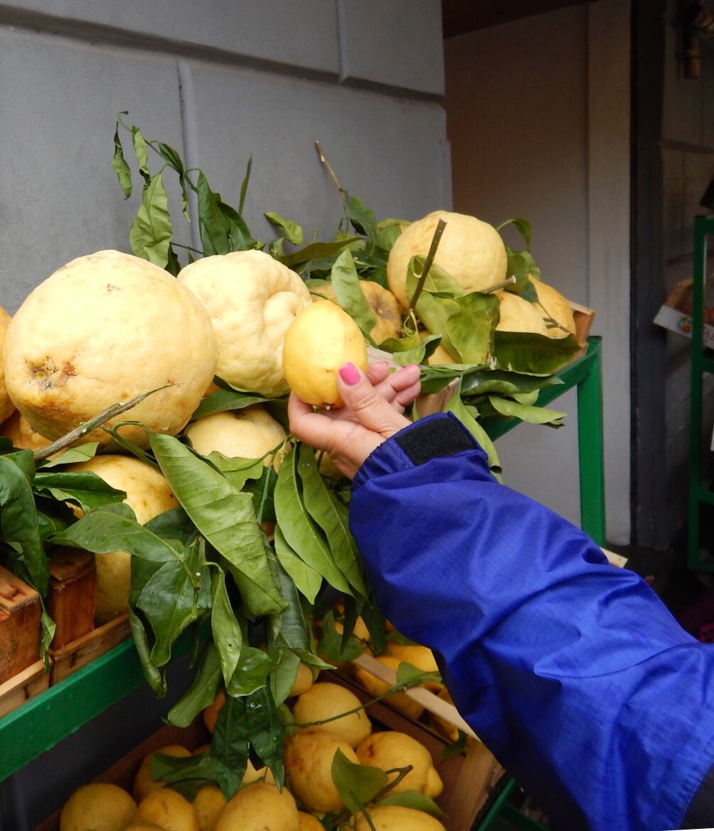
After lunch we walked around the town. There was an outdoor market that had the biggest lemons I have ever seen!
We also visited a store that had beautiful wood furniture with a type of inlay that was beautiful. We then boarded our motor coach for the hour-long trip to Pompeii driving through the region of Napoli. Naples is the third largest Italian city after Rome and Milan. It is the largest metropolitan city in southern Italy and is located at the northern part of the bay of Naples.

Pompei

For 800 years it was a thriving city until it was destroyed by Mt. Vesuvius. This mountain is still active today. Its last eruption was in 1944, but it is still considered an active volcano. Although “resting,” or dormant at the moment, it is considered the most dangerous volcano in the world because if it erupts violently again, it will impact the city of Naples where more than 1 million people reside. Italian authorities do have an evacuation plan for those who live in the “red zone,” which includes the city of Naples. Volcanologists say they can determine if a volcanic eruption is imminent from all the devices they have installed on Mt. Vesuvius, and they can alert the public well in advance of an impending eruption.
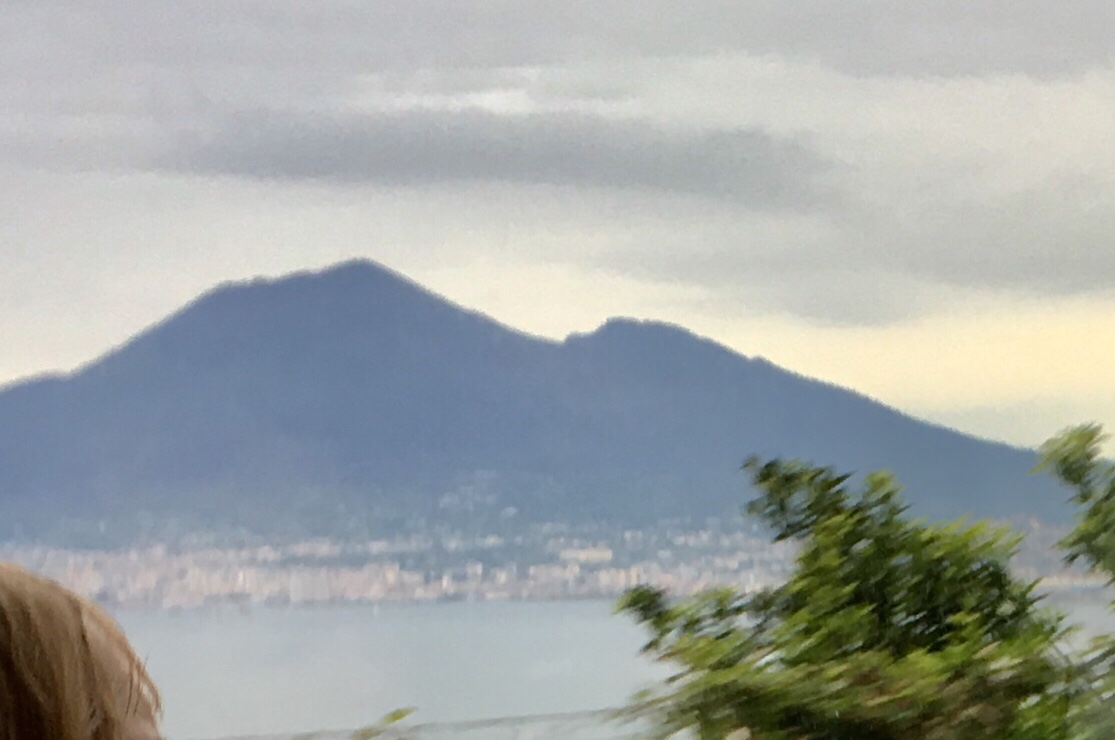
Mt. Vesuvius

One plus of the eruptions is that the soil is enriched with volcanic minerals making it very fertile. The main agricultural crop grown here is the olive, and there are twenty different “tastes” of olives produced here. Next, grapes are grown for the wine of this region. The third crop is the lemon from which limón cello is made, and tomatoes are the fourth main vegetable grown here in the very arable soil.

History of Pompeii: In the 7th century BC, there was a functioning harbor here and an independent thriving city. By the 3rd century BC, Pompeii was under Roman rule. In 79 AD, the top of Vesuvius exploded violently spewing tons of ash and debris into the atmosphere and down upon the unsuspecting towns of Pompeii and Herculaneum. (This was approximately 75 years after the birth of Jesus.) For 3 days, volcanic debris and ash rained down upon the city of Pompeii. During the eruption most of the inhabitants of Pompeii fled. There are only 1,200 deaths that are known today, and they would be those who were unable to flee the city. These people, the elderly, the sick, and the very young, died from suffocation from the volcanic gases and ashes. The city was buried in 30 feet of volcanic ash, and the volcanic debris created a 3-mile extension of the coast of Pompeii. What once was the thriving harbor of Pompeii was now new land formed by the volcanic ash and lava.
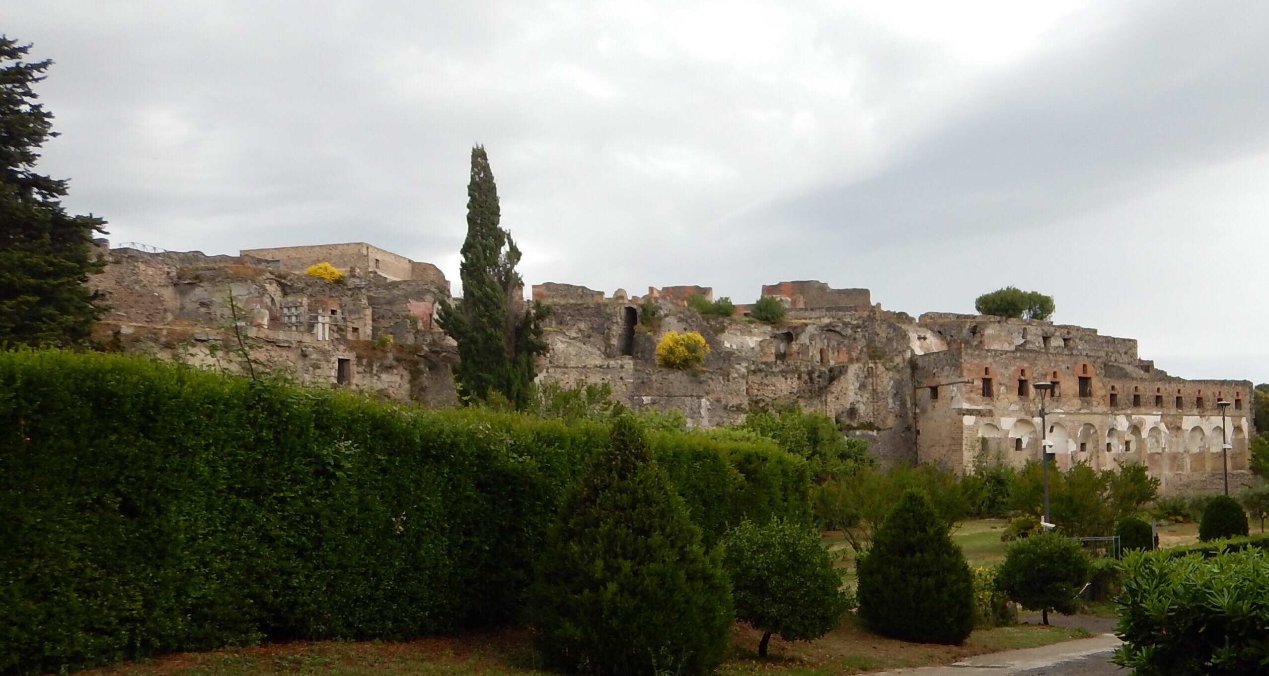
In the early 1700s, a farmer discovered some of the remains of Pompeii when he was digging a well. In 1748, King Charles of Bourbon ordered the excavation to begin. Today only 2/3 of Pompeii has been uncovered. This is approximately 165 acres. Excavation has been stopped for about 10 years now, leaving 55 acres still to be excavated at a later date.

As we walked through the ruins, we found that many of the things we see today were also apparent in Pompeii. Examples are sliding doors, pedestrian crosswalks, sidewalks, and speed bumps! Since there was no electricity, the people of Pompeii implanted white marble pieces in their cobbled roads that would reflect torchlight at night, serving as a rather primitive type of “night light” for the pedestrian to follow.
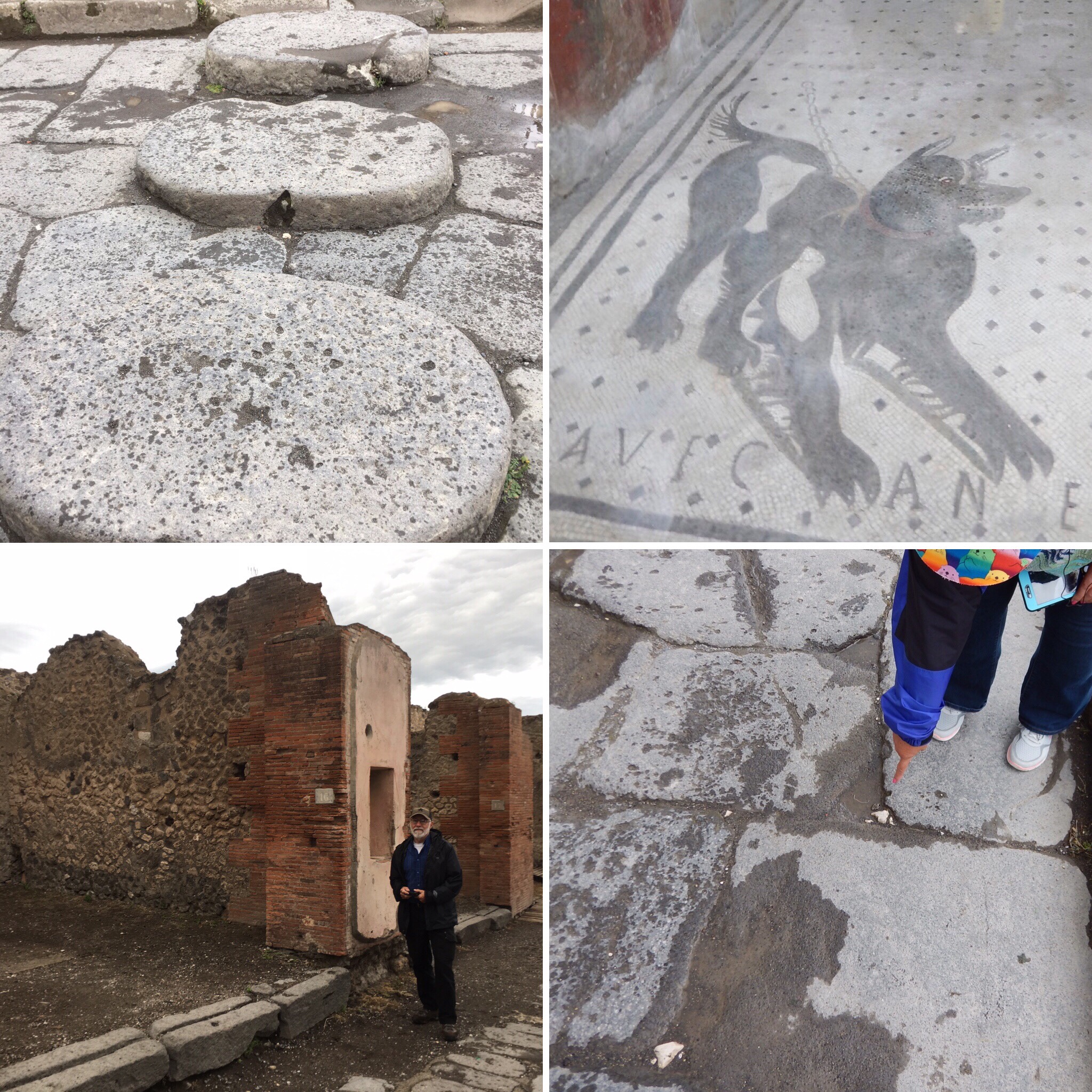
Clockwise from top-left: stepping stones (crosswalk); “beware of dog” carving; marble pieces to reflect torchlight; ruts in concrete blocks are for sliding a door or gate to open.

Pompeii was a very developed city. 35 bakeries have been excavated as well as many eateries, public fountains, and other businesses. Structures in Pompeii were made of basalt, terrecotta tile, and marble. The fountains were not only used for drinking, but they were also used to wash the streets and clear them of waste! Bakeries milled their own flour as evidenced by the grinding mills in them. The main square, also known as the Forum, was a pedestrian area. There were no carts allowed, so if you had to carry goods from one end of town to the other, you could rent an animal to do so. There are buildings that have engraved pictures of the animals that could be rented. At one end of the Forum was a huge temple dedicated to Jupiter, the Roman equivalent of the Greek god, Zeus. This temple was flanked by two arches. One was dedicated to Nero and the other to Caligula.
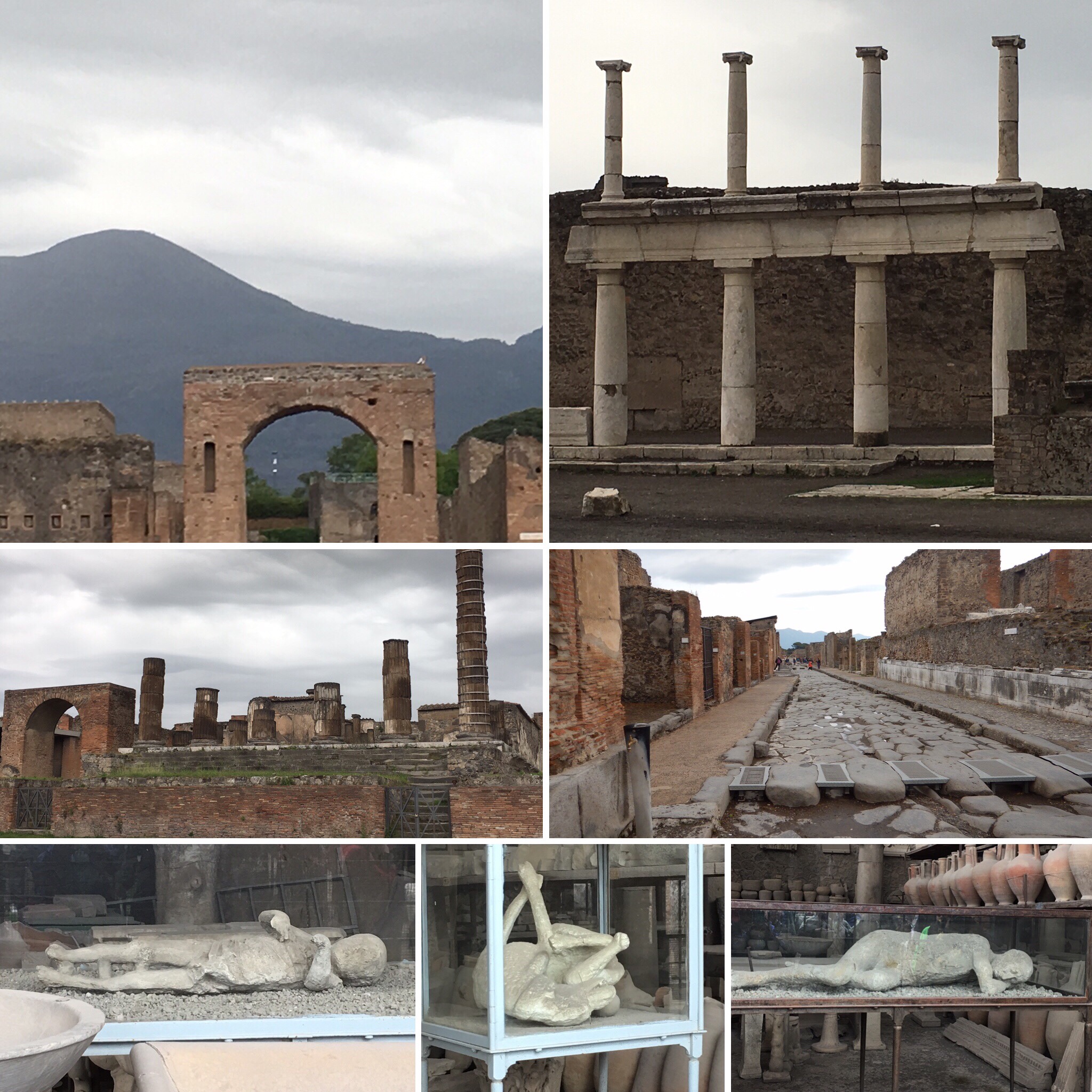
Clockwise from top-left: Vesuvius looms over Pompeii; pillars from the main square or Forum; Pompeii street; adult body; dog body; 3-year old boy body; temple of Jupiter

Herculaneum

This city was located at the foot of Mt. Vesuvius. Approximately 5,000 people lived there, and they all died during the eruption. Most likely a pyroclastic flow engulfed the city before anyone had an opportunity to flee. As this boiling volcanic sludge cooled and hardened, it preserved the trapped citizens of the city. Today, only a small amount of the city has been excavated because a new city had been built upon the remains before anyone realized there was a city buried beneath the surface. It is believed that only 25% of the city has been excavated.

Cameo Factory

Cameos are a type of jewelry made from seashells, mother of pearl, or coral. It is intricately carved by a master cameo maker into profiles of women (most common), animals or flowers. The more detailed the design, the more expensive the piece. While cameos are usually white or cream colored, some can be blue or pinkish. We were able to watch a master cameo maker work on a cameo. He was creating the curls of a woman’s hair on the cameo while looking through a magnifying glass while carving.
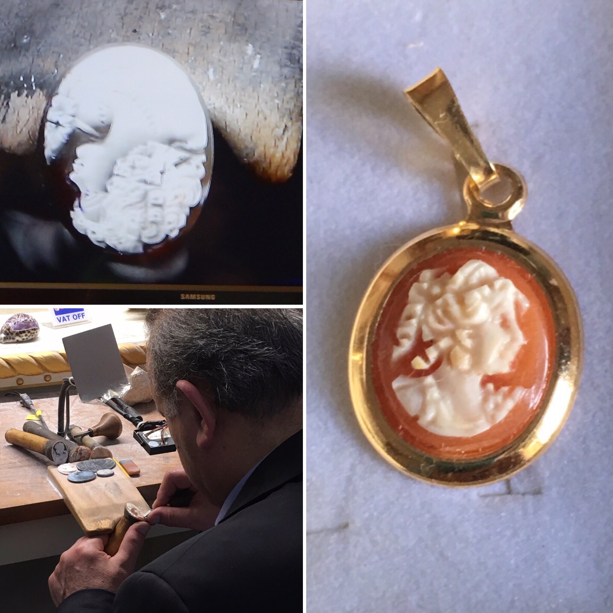
Top-left: cameo being carved. Bottom-left: master cameo maker. Right: finished product.

Next stop: Kotor, Montenegro
Civitavecchia, Italy

“But I am like a green olive tree in the house of God: I trust in the mercy of God for ever and ever.” Psalm 52:8

What a lovely day to visit the Tuscan countryside! Cool temperatures (60s-70s) and blue skies greeted us this morning.
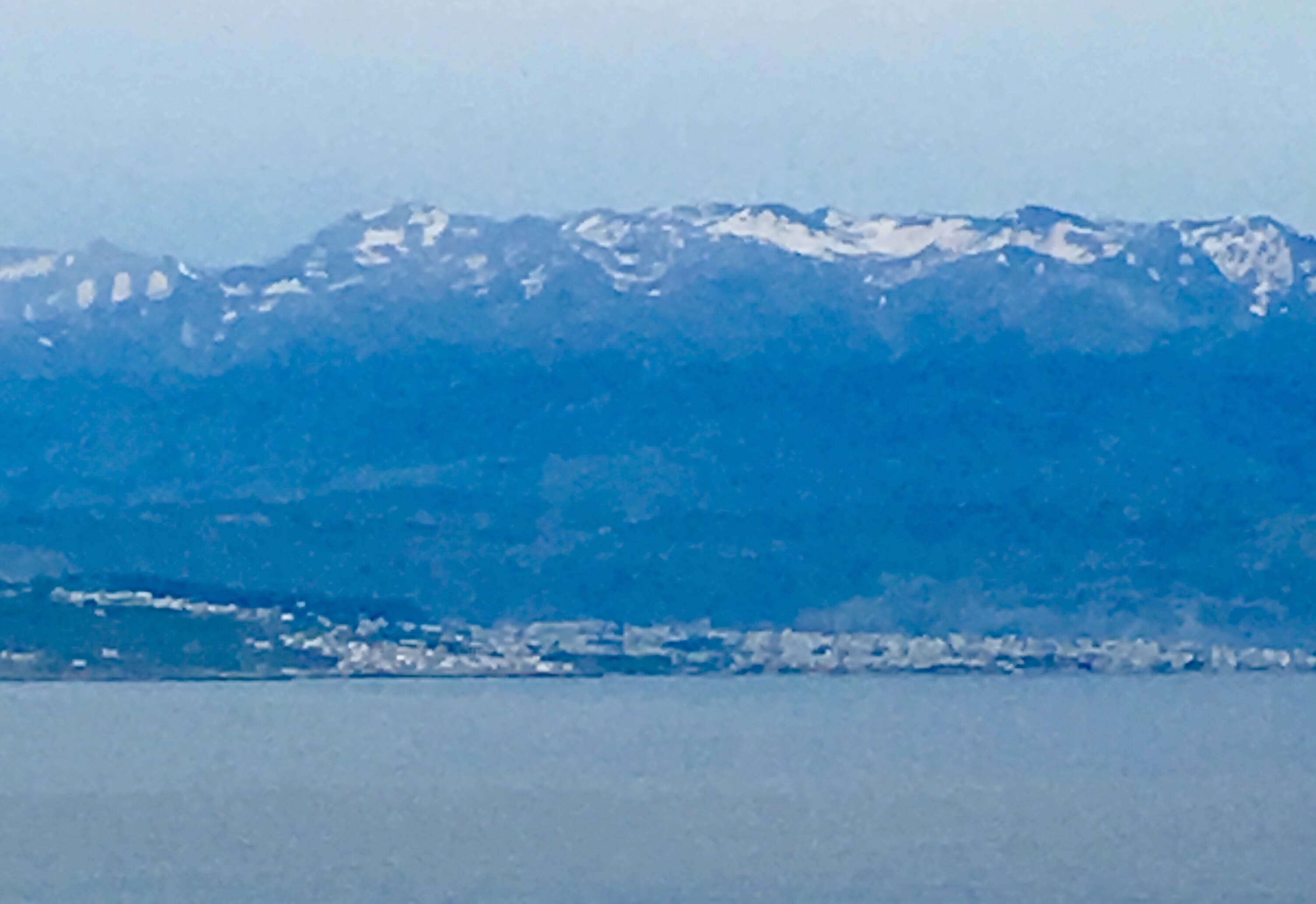
Built in the second century, this city is about one hour northwest of Rome. It is the largest port in central Italy and the gateway to Sicily and other Italian islands.

Tuscania

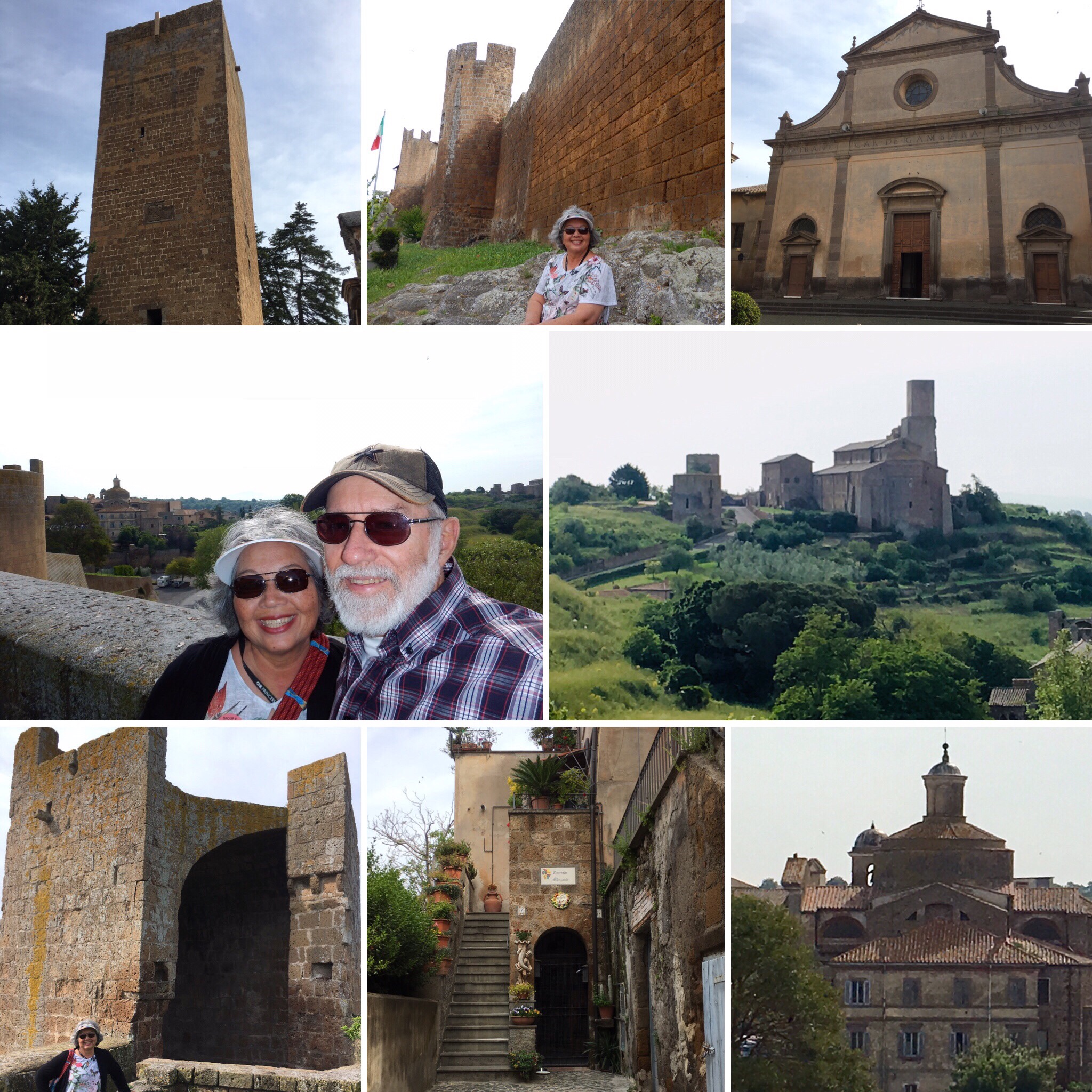
On our way to our first excursion, we drove through the countryside where we saw many olive tree groves. Olives are the main crop in this area, but watermelons, artichokes, and tomatoes are also grown here. The city of Tuscania is located north of Civitavecchia, and it is of Etruscan origin. The Etruscan people were great sailors and traded with Greeks, Egyptians, and Phoenicians. Olive oil and wine were what they most often traded. Etruscans believed in an afterlife and left valuable objects in the “necropolis,” or city of the dead (cemetery). Eventually, the Etruscans were conquered by the Romans and assimilated into their culture. During our time in Tuscania, we visited the medieval section of the town and walked on its cobblestone streets. Lavello Tower, a large stone structure, was at the end of the main cobbled street and at the top of St. Peter’s Hill. Gazing out over the stone walls surrounding the area, we saw an old church and various other ancient structures on a not-too-distant hillside.

Clockwise from top-left: Lavello Tower; city wall of medieval Tuscania; Cathedral of San Giacomo Maggiore; view from Lavello Tower; old church; residence in Old Tuscania; city wall corner section; at the top of St. Peter’s Hill.

Valentini Olive Farm Visit

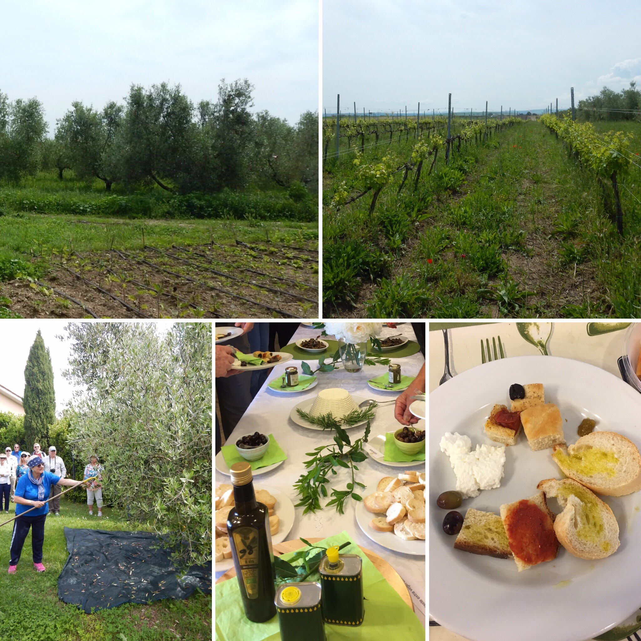
Meandering through the Tuscan countryside, we followed a narrow road to the Valentini Olive Farm. Here we had a demonstration on how olives are harvested. When they are ready to be picked, they are actually raked off the branches with a special net and dropped on to a special meeting below the trees. The olives are then taken to the presses. Olives that are the first of the season to be pressed produce the oil that will become known as “extra virgin olive oil.” It is green and has the best flavor. Our visit to an olive farm culminated with an opportunity to sample the delicious oil! In addition, we had bruschetta, tomato jam, ricotta cheese, olives (of course!), and fresh bread. An added treat was a bowl of penne pasta in a savory tomato sauce. What a special treat!

Clockwise from top-left: olive trees; vineyard; tasty samples; olive oil and other snacks; demonstration of olive harvesting

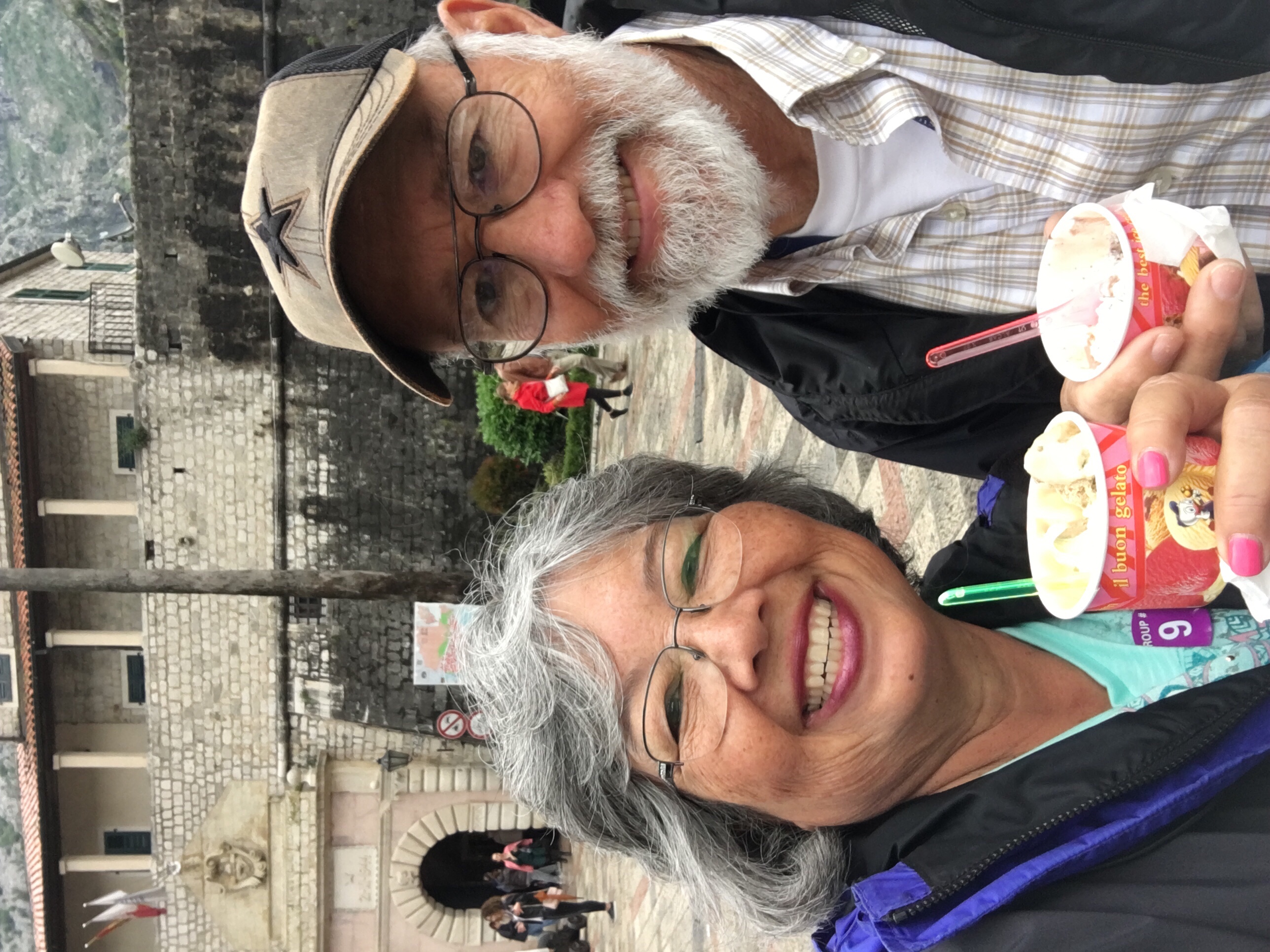
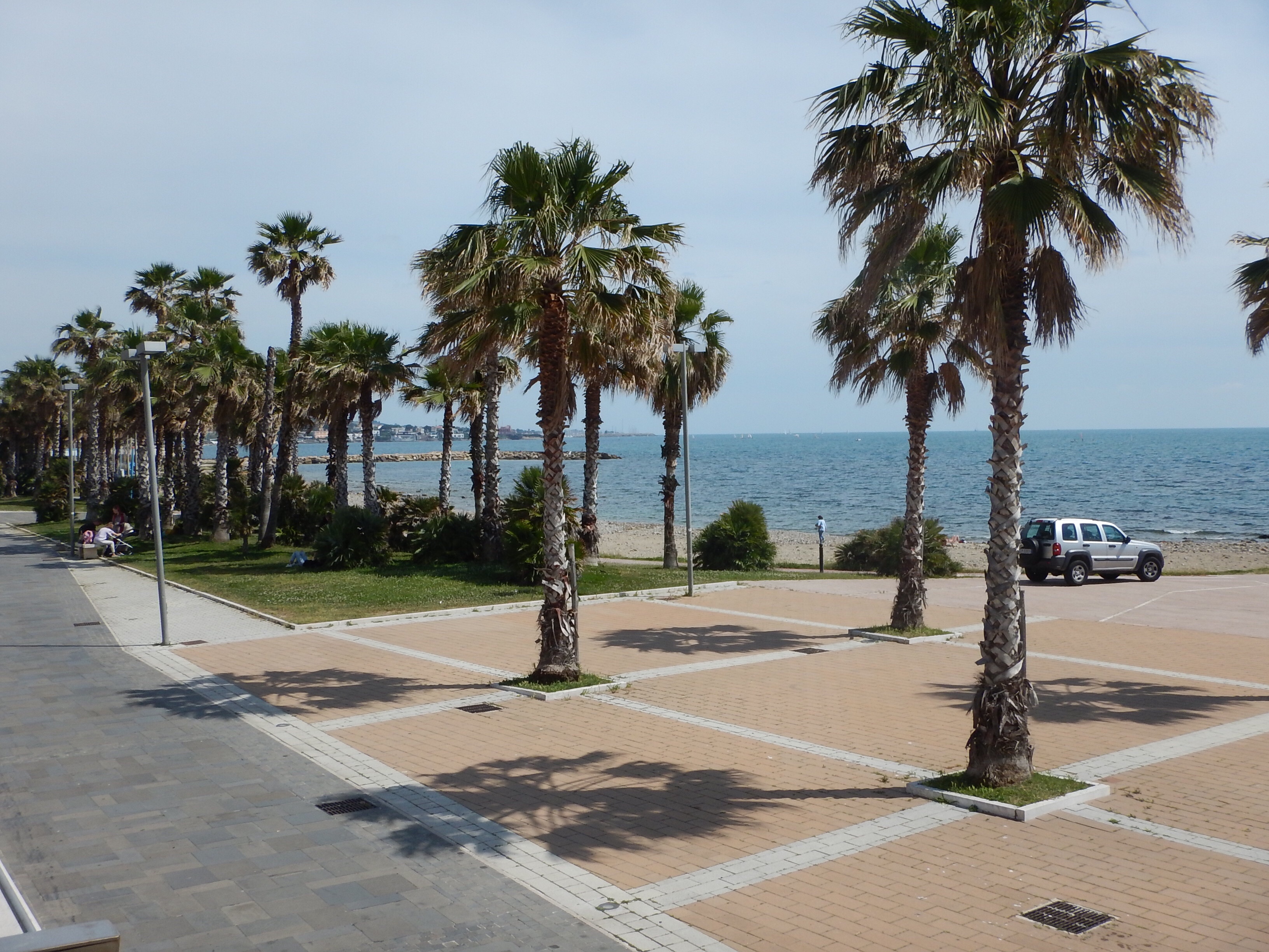
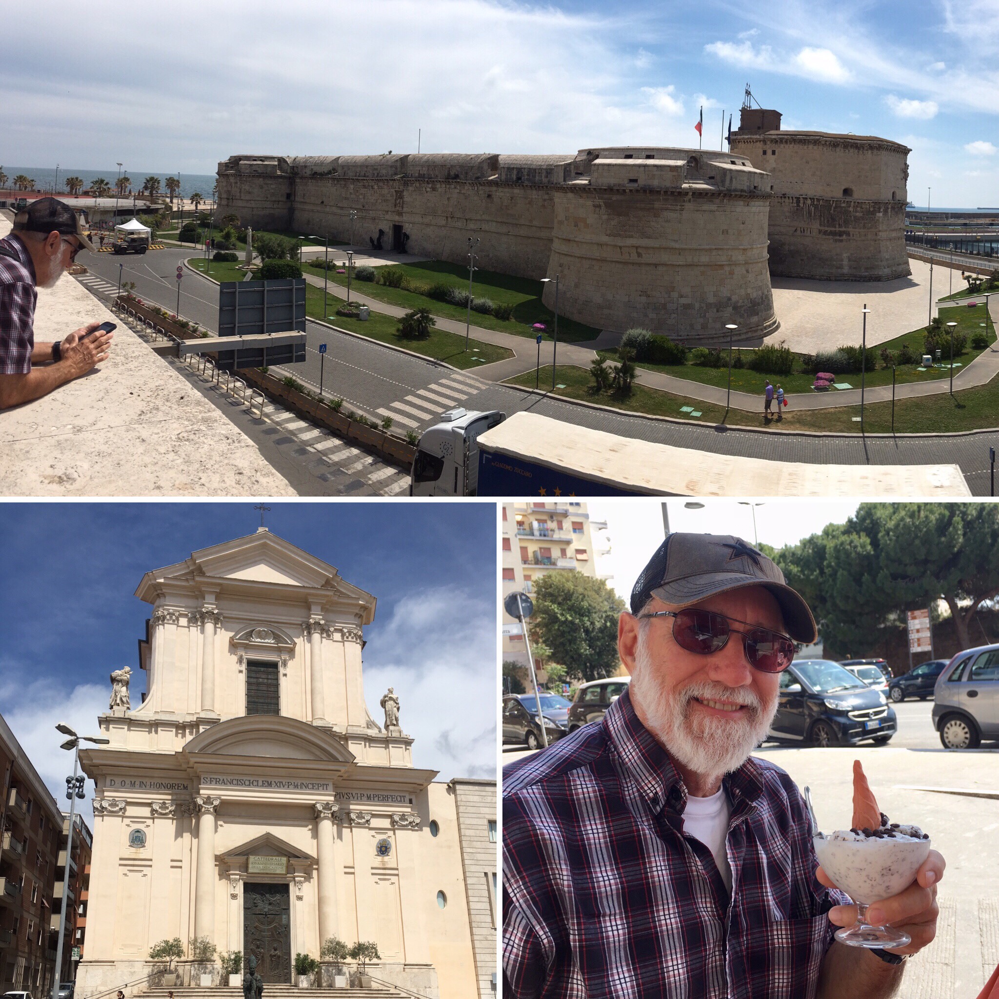
Strolling through Civitaveccha was a great way to end our day. There was a beautiful walkway along the Mediterranean Sea, and we were able to see Michelangelo’s Fort as we walked. Last, but certainly not least, we found a nice place to sit, rest, and enjoy the scenery… well, maybe there was a little more incentive for John to stop at this particular place!

Top: Michelangelo’s Fort. Bottom-left: Civitavecchia Cathedral. Bottom-right: John and his gelato.

Next stop: Pompeii and Capri

Pisa, Italy

“The name of the LORD is a strong tower: the righteous runneth into it, and is safe.” Proverbs 18:10

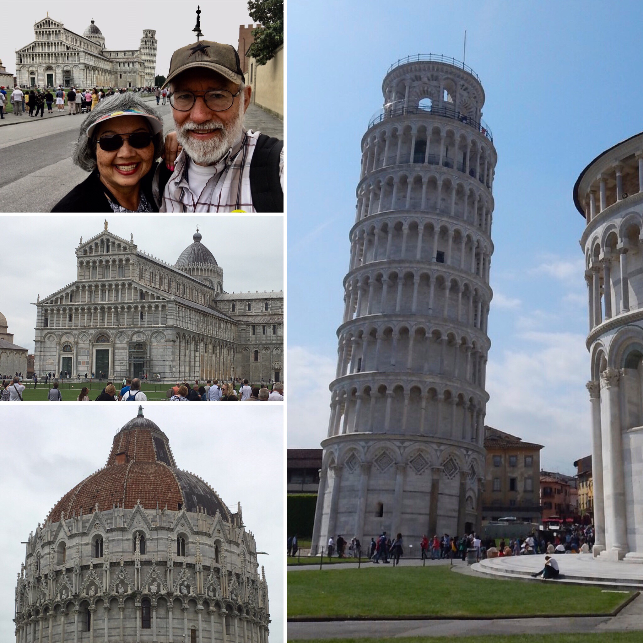
Pisa is about 20 km from Livorno with the Arno river running through it. It was an independent city-state during the medieval times and was founded by the Tuscans prior to the Romans being here. The Field of Miracles is the main square in Pisa, but no miracles have actually happened here. The area was dubbed that by an Italian poet.

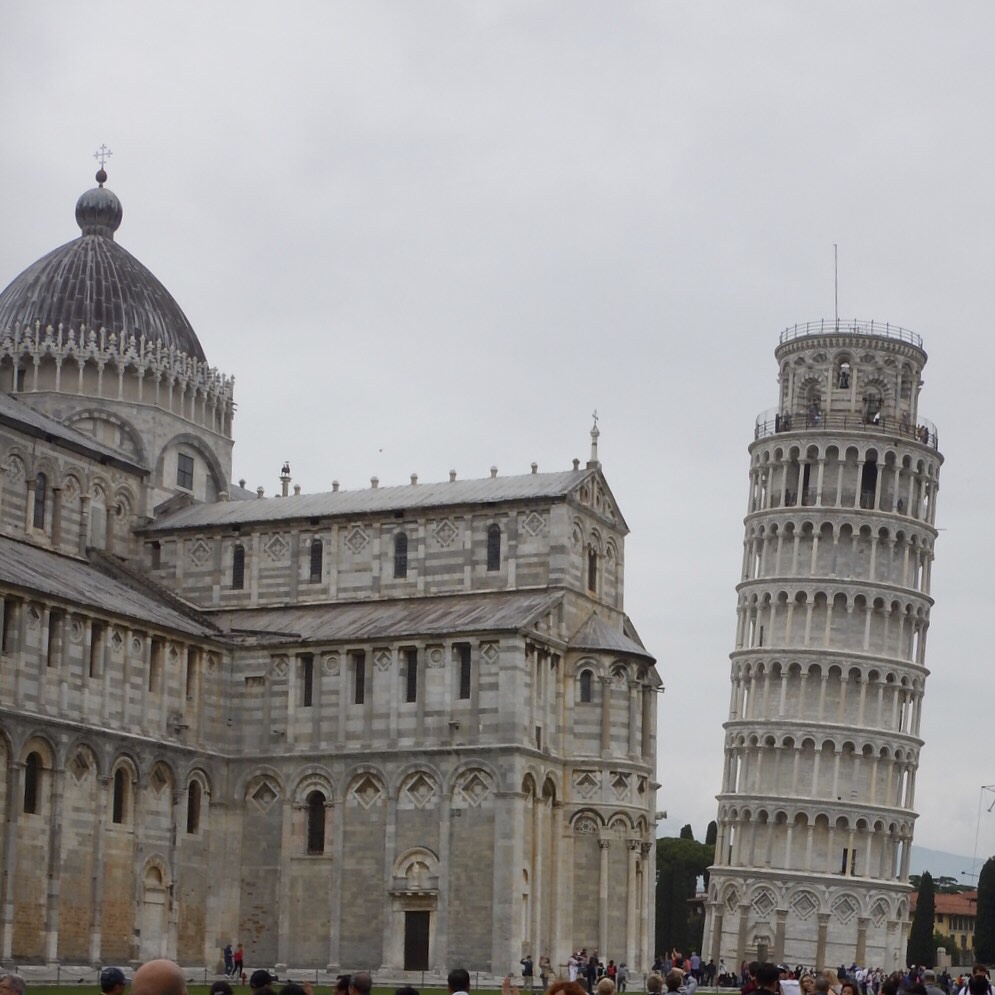
The famous leaning tower is actually the bell tower for the Cathedral of Santa Maria. Building began in 1173, and unfortunately, the ground was not as stable as the builders had originally thought. The tower began to lean almost immediately because the unsettled soil could not support the weight of the marble tower. Construction stopped for about 100 years, which was a good thing because it gave time for the ground to settle. At this time, only four levels had been completed. Construction began again in 1273 from the fourth to seventh floors, and the tower was finally finished. In 1990, the tower’s leaning was understood better. It actually leans because one side is rising from bubbles in the underground clay which push the tower up on one side as they move to the surface.

Builders finally had to remove soil from beneath the tower to stabilize it. It was reopened in 2001 for tourists to climb. Architects say it is just a matter of time before the tower actually topples over, but it is not expected to do so for at least 300 years. The tower stands 58 meters tall and is completely made of marble. It weighs approximately 13,000 tons.

On the grounds of the Field of Miracles are several buildings. The tall round building is the baptistery (built 1150-1155), and the cathedral is behind it, between the baptistery and tower. The cathedral, or Duomo, was the first structure built here. It was constructed during the Crusades and dedicated to the Virgin Mary. Although it is predominantly Roman architecture, there are a lot of Islamic influences that can be identified.

Clockwise from top-left: Entering the Field of Miracles; the Leaning Tower of Pisa; the baptistery; Duomo

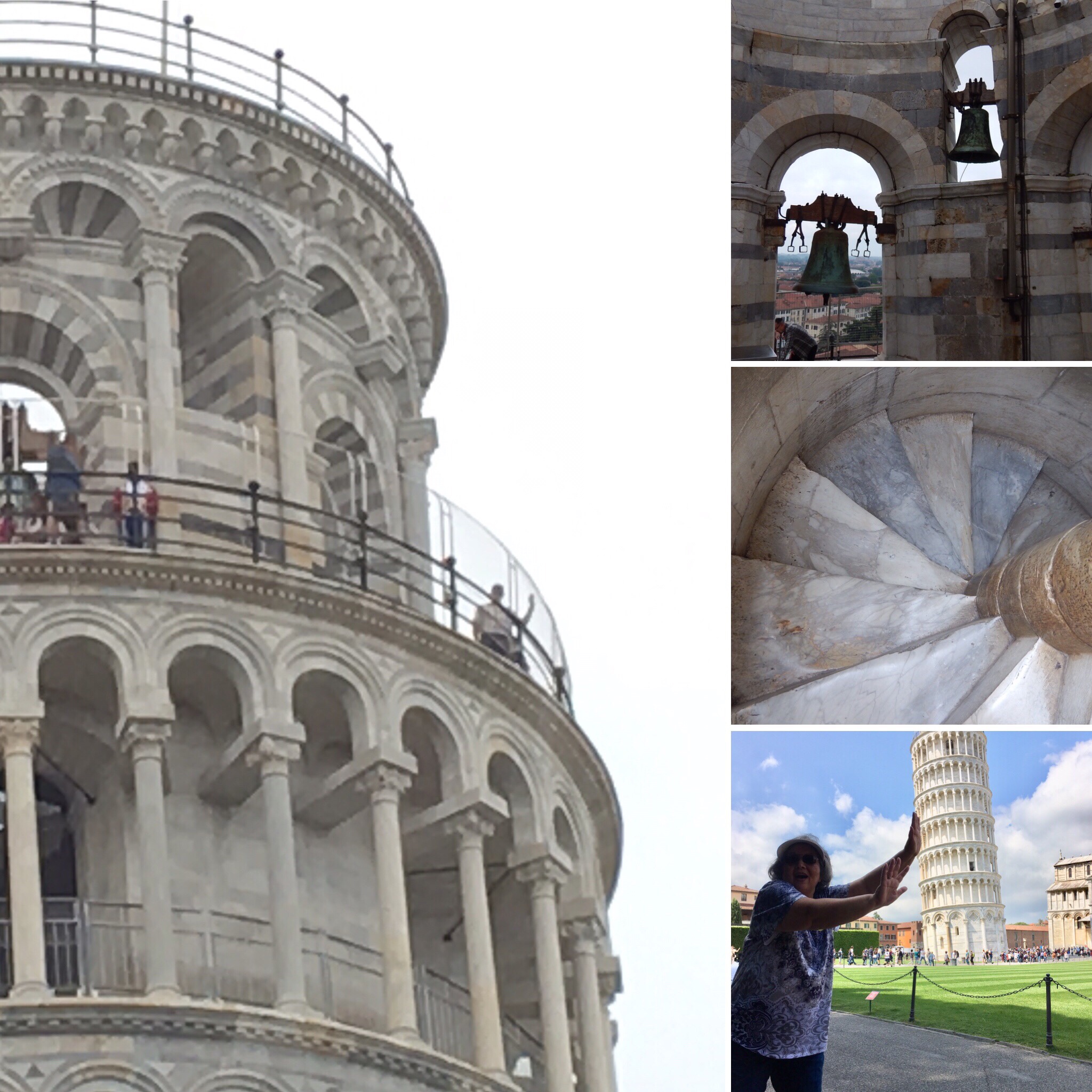
While John climbed to the top of the tower, I stayed below to keep the tower from falling!

Left: John is on the far right; top-right: bells in the tower; middle-right: staircase inside the tower; lower-right: Jayne supports the tower.

Next stop: Rome, Italy

Genoa, Italy

“And he saith unto them, Follow me, and I will make you fishers of men.” Matthew 4:19

Genoa is Italy’s 6th largest city, and it is surrounded by mountains and sea. Christopher Columbus was born here, and the international airport is named for him. In the past, there were 20 fortresses protecting the city in the mountains, and a Genoese sea army protected it from ocean attacks.

Today we traveled by boat to Portofino, Santa Margherita, and Camogli, three coastal villages. As we headed out of the port of Genoa, we saw several of the forts on the nearby mountains. As we sailed, we passed San Fruttuoso – an abbey nestled at the base of coastal mountains on the beach. It was originally built by monks, but it is no longer a monastery. Today, it is a museum and public beach.

We then sailed around the Portofino lighthouse and saw beautiful multicolored homes on the hillside. We also passed by the Nature Park of Portofino, a protected area since 1945.

Santa Margherita

Santa Margherita was our first coastal village. Right at the end of our pier, was a park with lots of statues including a green statue of the first king of Italy, Vitorrio Emanuele. We walked to the Center Square of Santa Margherita and saw its 1st church dedicated to St. Margaret. It is a 17th century church – Baroque style architecture. Frescos, floors and side chapels use colored marble, and there are also paintings that decorate the church.

Clockwise from top-left: Santa Margherita bay; Columbus statue; Santa Margherita church; Santa Margherita statue

After visiting the church, we strolled through the narrow streets and saw pasta making shops, cheese and salami shops, candy and pastry shops. And then we saw it! A gelateria! Time for our first gelato! John had dark chocolate, and I had pistachio. What a glorious treat!!

Clockwise from top-left: cookies and spreads; sampling our first gelatos; fresh produce; tourist shopper; making fresh ravioli

Portofino

Portofino is a fishing village on the western shore of Italy near Genoa. The houses here are different colors, so the fishermen at sea could easily identify which house was theirs. St. George is the patron saint of Portofino. St. George’s church was destroyed in WWII, then rebuilt. The view from the church was awesome.

We had independent time, so off we went. Guess what John found? Another gelateria! And he found his favorite flavor: stracciotella (chocolate chip)! He has found his souvenir, and I being a supportive wife had to have another one too! Delish!

Camogli

Our last village was Camogli. On our way, the boat cruised by the abbey again in the Nature Park of Portofino. Camogli is a small fishing village that is definitely not a tourist spot. We did find a place that sold focaccia, pizza, and brioche, so we bought a focaccia with tomato and olive oil. It was really delicious! This is a very hilly town, and John wanted to know what the upper street was like, so off he went! I documented his quest from down below! Finally, he came back, and we headed back to the waterfront. However, we had one more stop – a gelateria!

Left: stairs to adjacent street. Top-right: sampling focaccia. Bottom-right: chocolate gelato.

Next stop: Florence and Pisa!

Marseille, France

“Make a joyful noise unto the LORD, all ye lands.” Psalm 109:1

Marseille is France’s first port, and it’s oldest French town. Today, it is the second largest in population with 875,000 people living here (Paris is first). Founded by Greek sailors, Marseille has a rocky coastline with fishing villages and summer resorts. Hills and mountains are all around the city, and lots of aromatic herbs grow here – thyme and rosemary are the most famous.

Clockwise from top-left: sign on the hill; Arc de Triomphe; Notre Dame de la Garde basilica; sailboat marina; prison island from the novel Count of Monte Cristo by Alexandre Dumas.

Basilica – Notre Dame de la Garde

This cathedral was built in a 46-year period (1853-1899). It sits atop a hill overlooking Marseille and the bay. There is a gold statue of smart on top of the bell tower.

Aix-en-Provence

Founded by Roman soldiers, Aix-en-Provence is the second town founded in southern France. Located about two hours from the French Alps, it was established about 122 years before Christ, and from 972 AD to 1481, it was an independent country. Aix-en-Provence is known for its warm water springs, which the Romans used to create their public baths. Because of the many springs, the city has lots of fountains. Today, nearly 90,000 people live here.

Cathédrale Saint-Sauveur

There are three knaves, or sections, in this church, and they were built at different times. The first knave was built by the Romans circa 300 AD. The baptismal area is from this time period. The second knave was built in the 13th century. The altar area shows the gothic architecture and there are many stained glass windows. The third knave is from the 17th century and is baroque architecture. There is a greater use of gold and marble as well as more statues in this section.

Placo de Hotel de Ville – Town Hall Square

This is where the government offices are in Aix-en-Provence. Over the doors of the Town Hall are three flags. They are the EU flag, the French flag, and the Catalán region flag. (The Count of Barcelona, in the region of Catalonia, was also the count of this region). Next to the Town Hall is the Post Office building, which has a facade with wheat on one side and grapes on the other which represent the region’s agricultural staples.

Farmers’ Market Square

Lots of produce is sold here including lavender (the region is known for this), honey, breads, and meats.

Fountains

Fountains are all throughout Aix-en-Provence. The first fountain was built in 1618 in the square “Anciano Placo de L’Archevescat.” It was also in this square that the French Resistance first met to plan its war efforts against Germany in WWII.

Clockwise from top-left: 1st fountain in Anciano Placo de L’Archevescat, Placo de Alberta fountain, Town Hall fountain, Main Street fountain, Four Dolphins fountain

Bastide du Cours

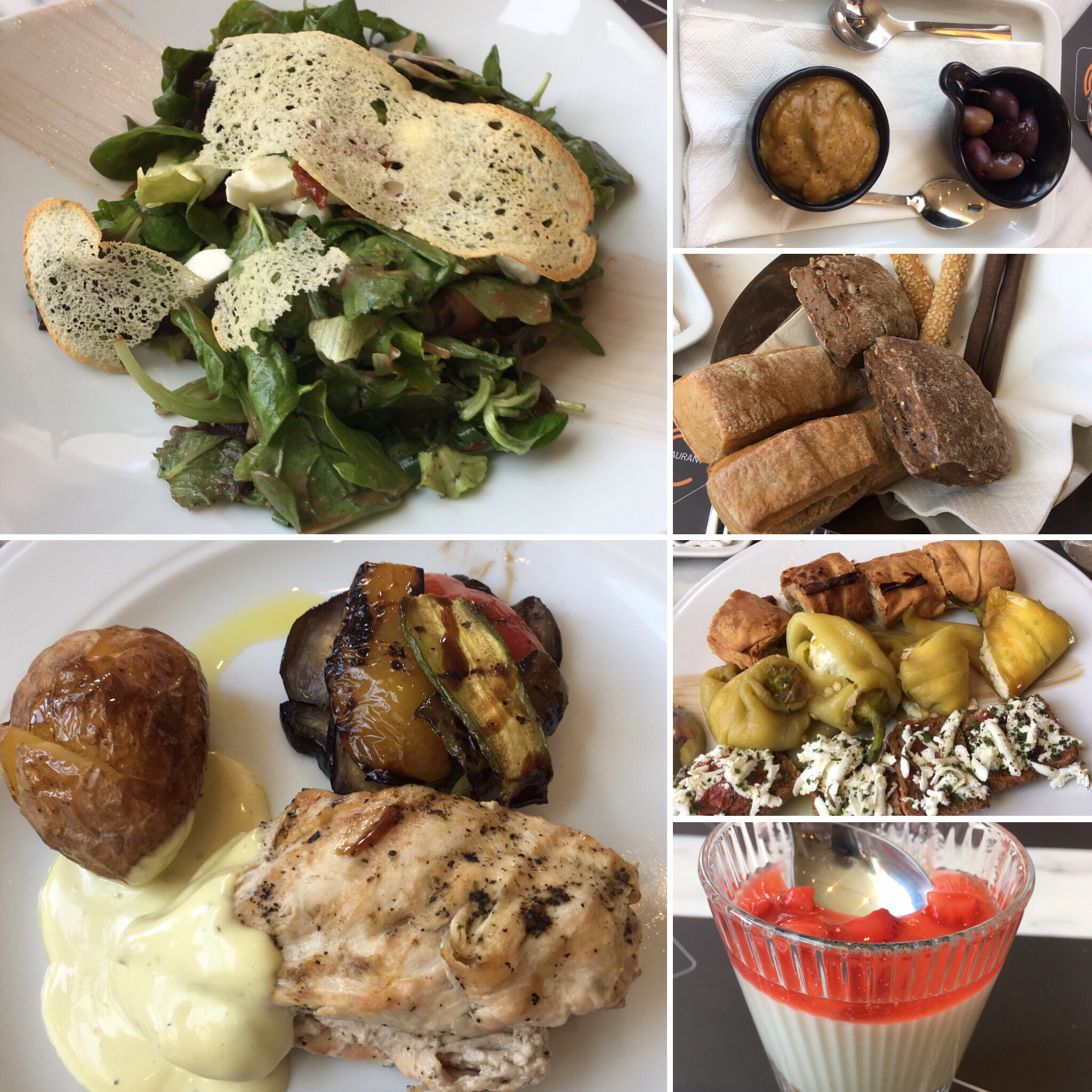
Lunch was at the Bastide du Cours restaurant in Aix-en-Provence. We had mixed greens with goat cheese and bread to start, then chicken with veggies as the entree. Dessert was a strawberry mousse cake with blueberries and cranberries.

Next stop: Genoa, Italy!

Calm Seas

Psalm 107:29 “He maketh the storm a calm, so that the waves thereof are still.”

Calm seas. I suppose that is every sailor’s dream. No one really wants to sail through a storm. This morning, as we sailed into the Mediterranean Sea, the seas were amazingly calm; it was like looking at a lake! Not a single whitecap could be seen in any direction. If there had been a dolphin or whale nearby, it would have easily been spotted! We have been blessed with incredible weather and seas on this trip. Even our Atlantic crossing was uneventful in terms of sea conditions. No storms, no huge waves. It has been a very peaceful journey.

Reminds me of life. We all relish days that are like calm seas. No worries or cares to invade our lives. No problems on the horizon. Smooth sailing ahead! But it’s not always like that. In fact, it is inevitable that storms will arise in our lives. We don’t know when they will come or how long they will last, but they will come. The good news is that no storm lasts forever. Tempests at sea eventually die down, and calm seas return. The task is to keep an even keel while navigating through the storms, employing the skills we have learned to safely sail through them until the skies become clear, and the seas settle down once more.

Just as a sailor keeps constant contact with his captain, we must maintain close communion with our Captain in order to maintain a godly heading in life. The Lord will never lead us astray. Reading His Word and praying to Him will help us safely sail through the troubled waters of life. It is an undeniable fact that storms will come. Some will be frightening; some will be painful; some will seem hopeless, but through each one, God has promised to be with us, guiding us, helping us, and delivering us safely through them.

It is true that even with the knowledge that God is in control, it is still difficult to undergo the trials and tribulations of life. We must strive to have the proper perspective. In our own frailties, the storms we face may seem insurmountable, but when we focus on God’s power as our source of strength, we can know that no matter what storms lie ahead, we have the assurance that we will weather each one successfully if we stay the course. God is manning the helm, and He is aware of all the unseen obstacles ahead. He knows exactly how to navigate through them. If we remain at His side and trust in Him, we will soon emerge from the raging tempest into blue skies and tranquil seas!

“And He arose, and rebuked the wind, and said to the sea, Peace, be still. And the wind ceased, and there was a great calm.” Mark 4:39

**********

Can you remember a time in your life when God calmed your storm? Praise Him for that today!

Gibraltar

“…Lead me to the rock that is higher than I.” Psalm 61:2b

Gibraltar is an overseas territory of the United Kingdom and has been so since 1704 when the British defeated Spain in the War of Spanish Succession. Gibraltar is located on the southern tip of the Iberian Peninsula, and lies at the entrance to the Mediterranean Sea. It is a very small country (less than 3 square miles), but very diverse in its population of 30,000. The famous Rock of Gibraltar is the limestone sentinel that stands watch over the Straits of Gibraltar, the waterway link between the Atlantic Ocean and Mediterranean Sea. Located at the southernmost peak of Gibraltar, Europa Point is the “end of Europe.” From here you can see northern Africa and Spain. According to Greek legend, Hercules held on to Gibraltar, the “pillars of Hercules,” when he pulled Africa and Spain apart.

On the bottom photo, the mountains of Morocco are visible on the left, and on the right is Spain.

St. Michael’s Cave is a limestone formation with many huge stalagmites and stalactites throughout it. Illuminated by colored lights, it gives a surreal feeling to a “naturally formed” cave. The cave opens up into a huge amphitheater which is actually used for musical concerts!

Perhaps one of the most well known attractions in Gibraltar are the Barbary Apes. They are not really apes at all, but instead they are tail-less monkeys! They are actually named the Barbary Macaques. No one really knows how they got here, but there are about 250 roaming freely in Gibraltar. One unusual fact about the Barbary apes is that the fathers help care for their young! Winston Churchill is known for saying that as long as there were the monkeys on Gibraltar, it would remain in the British empire.

The Gibraltar airport has its main and only runway crossed by a city street and pedestrian walkway. The airport is considered the 4th most dangerous airport in the world because westerly winds create increased turbulence here. If after three attempts, a plane cannot land due to the turbulence, it is redirected to Malaga, Spain for landing, and the passengers are then shuttled back to Gibraltar.

Clockwise from top-left: airport control tower; standing on the runway; on runway with “The Rock” behind us; a “plane” landing

Next stop: Marseilles, France

Barcelona, Spain

“All the ends of the world shall remember and turn unto the LORD: and all the kindreds of the nations shall worship before thee.” Psalm 22:27

Barcelona is the beautiful capital city of Catalonia, a region of 1.7 million people. It was here that Columbus returned from the New World to meet with Queen Isabella. Barcelona is known for many things, such as the 1992 Olympics and the childhood home of Pablo Picasso.

Cathedral of Barcelona

This cathedral was built on the style of gothic architecture as shown by the pointed arches.

La Sagrada Familia

This church was designed by Gaudi, a famous Catalán architect. Construction began in 1882, and the current plan is for it to be completed in 2026. The central tower, which represents Jesus, will eventually be 110 meters tall. The nativity facade in the front of the church is the only one actually built by Gaudi

before he died. The life of Christ is depicted in the facades around the church. His birth and childhood is on the east side (where the sun rises), and His death and resurrection is on the west side of the church (where the sun sets).

Clockwise from top-left: cathedral; marriage of Joseph and Mary; nativity; fleeing to Egypt

The cypress tree represents eternal life, and the different fruits represent the twelve months of the year.

Clockwise from top- left: cathedral spirals; crucifixion; cypress tree with fives; fruits on top of arches.

Other Barcelona highlights

Clockwise from left: statue of Columbus; site of the palace of the Spanish Inquisition; Picasso artwork; Roman arch and aqueduct; Arc del Triomf

Next stop: Gibraltar

Malaga, Spain

“Kings of the earth, and all people; princes, and all judges of the earth: both young men, and maidens; old men, and children: let them praise the name of the LORD: for his name alone is excellent; his glory is above the earth and heaven.” Psalm 148:11-13

To reach Malaga from Cadiz, we had to sail through the Straits of Gibraltar, leaving the Atlantic Ocean and entering into the Mediterranean Sea. As we passed through the Straits, just after midnight, there was a lighted sign on a hillside that said “Gibraltar Cliffs.” The photo is not clear, but the large white blur on the right is the sign.

We arrived in the early morning at the Port of Malaga. The skies were clear and blue, and it promised to be a beautiful day for us. We had a 1.5 hour drive to our destination, the city of Granada, so we were among the first to disembark for our tour. We began with a beautiful drive along the shoreline in Malaga. As we left the city and entered the countryside, I couldn’t help but notice that the terrain was very similar to that of southern California. It was dry with small shrubs, a few oaks. As we got farther from Malaga, we entered the agricultural area with orchards of olive and citrus trees, the same kind of scenery I remember seeing on highway 126 through Santa Paula, California. The hills outside of Malaga are covered with olive trees because apparently they grow very well in hilly regions, and Spanish olive oil is highly valued.

Malaga beach (top), countryside (bottom left), olive trees (bottom right)

Granada

Historically, Granada was the last independent kingdom before Spain became a unified country under King Ferdinand and Queen Isabella. Symbolized by the pomegranate, it is bordered by the Sierra Nevada Mountains, making Granada is a popular tourist attraction that nomads once referred to as paradise. Nearly 280,000 people now call Granada home.

The Sierra Nevada mountains can be seen beyond a grove of olive trees.

*Royal Chapel

This is the burial place of King Ferdinand and Queen Isabella. They wanted Granada to be their final resting place because it was their dream that Spain be unified, and Granada was the last independent kingdom.

From top-left, clockwise: Royal Chapel sign, Top of mausoleums, actual remains inside the tomb, Isabella’s crown and scepter

*Cathedral of Granada

It took 200 hundred years to build this cathedral, and as such it has two basic architectural styles: gothic and baroque. Its construction was commissioned by Philip, the grandson of Ferdinand and Isabella, and its interior looks more like a palace than a traditional cathedral.

Cathedral exterior

Clockwise from top-left: King Ferdinand (father of Spain) praying below Adam (father of mankind); stained glass; marble pillars; Queen Isabella (mother of Spain) praying below Eve (mother of mankind); altar area; alcove

*Alhambra

This was a fort built by the Moors around the 9th and 10th centuries to protect their communities. It is on a hill that overlooks the city of Granada in the Muslim quarter of the city.

The steep, cobblestoned road we climbed to get a view of the fortress led us by a variety of shops and sights. Arabic influence was evident throughout this section of the city in the streets, shops, and architecture.

Clockwise from top-left: steep, cobbled road up to viewpoint; restaurant; shot; detail of cobblestoned road; another shop

Next stop: Barcelona, Spain

Cadiz, Spain

For the preaching of the cross is to them that perish foolishness; but unto us which are saved it is the power of God.” 1 Corinthians 1:18

Cadiz was founded 100-150 years before Christ by Phoenicians. Today, there are about 200,000 people. It is located on a peninsula where two bridges link city to mainland. We crossed the 3 km long Constitution Bridge as we left the peninsula and headed toward Seville. Spain is a land heavily influenced by the Muslims, who had been on the Iberian peninsula for 800 years until Christians conquered the land.

Seville, Spain

Today the area around Seville is known for its sherry wine. It’s quality doesn’t depend on the year, but rather upon the taste of the “mother of the wine.” The oldest wine in the wine cellar is the “mother” and is mixed with the younger wines when they are being made. The darker the wine, the sweeter it is.

*In preparation for the Exposition of 1929, countries that participated built elaborate buildings representing themselves. Those buildings still remain, and many now are used as cultural centers for those individual countries.

*Casa de Pilatos – Pilate’s house

This was not actually Pilate’s house since it was built in the 15th century. Instead, the son of wealthy family visited Jerusalem and wanted to build this palace to commemorate the “stations of the Cross.” Pilate’s house (Praetorium) in Jerusalem is the first “station of the Cross,” which this palace was to represent. The architecture is similar to Arabic architecture (wood-plaster- mosaics) except instead of mosaics, ceramic tiles are used to cover the walls.

Clockwise from upper left: metalwork archway leading to courtyard (center); bust of Vespasian; Roman helmet; architecture; chapel; Spanish garden; goddess Artemis; Italian garden; courtyard.

*Cathedral de Sevilla

Currently being renovated, this is the world’s largest gothic cathedral, and it is here that the archbishop lives.

The bottom left photo is Christopher Columbus’ tomb. His bones are not buried in the crypt. Instead, they are being carried above it because Columbus stayed he did not want to be entombed.

*The Old Town

We strolled through the old section of Seville, through narrow and cobbled streets. Lots of little shops, places to eat, and town squares. We stopped for lunch at the San Marco restaurant.

Top: profiteroles with chocolate sauce

Bottom left: pork with raisin gravy and scalloped potatoes. Bottom right: salad

*Spanish Square

This was built by Spain for the Exposition of 1929. Each arch represents a state of Spain, and their names are in the ceramic tiles under their arch. The water represents the Atlantic Ocean, and the bridges connects Spain with the North American continent.

Today we walked about four miles. The weather was in the low 90’s, and it was a bit humid, but all in all, it was a very interesting and educational day.

Tomorrow: Granada, Spain